
ファイル:Coba Noloch Mull Pano-27527.jpg
このプレビューのサイズ: 800 × 140 ピクセル。 その他の解像度: 320 × 56 ピクセル | 640 × 112 ピクセル | 1,024 × 179 ピクセル | 1,280 × 224 ピクセル | 8,000 × 1,400 ピクセル。
元のファイル (8,000 × 1,400 ピクセル、ファイルサイズ: 3.7メガバイト、MIME タイプ: image/jpeg)
ウィキメディア・コモンズのファイルページにある説明を、以下に表示します。
|
概要
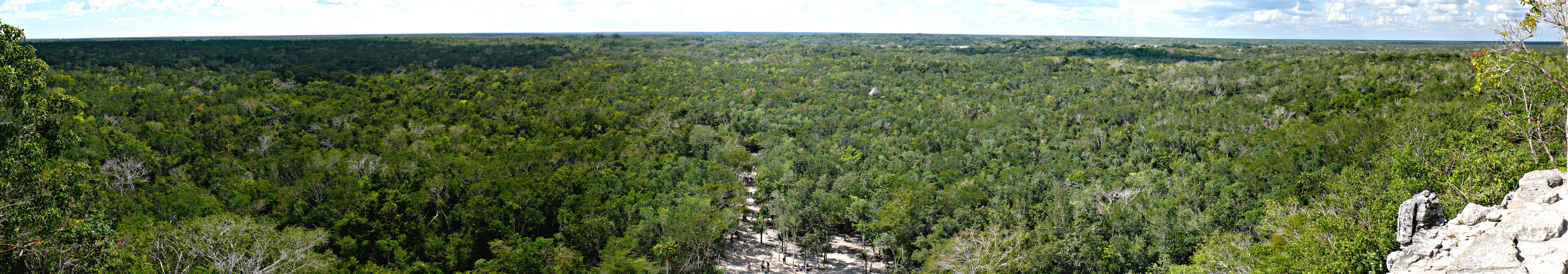
| 解説 | Miles and miles of jungle, as seen from the top of the Mayan Nohoch Mul pyramid on the northen edge of the Cobá archeological site in Quintana Roo, Mexico. Panoramic image compiled with Autostitch from twelve individual photographs, each taken with a Panasonic Lumix DMC-FZ50 mounted to a Panosaurus tripod head. |
| 日付 | 2008年2月1日, 12:15 −06:00 |
| 原典 |
KenThomas.us (personal website of photographer) |
| 作者 | Ken Thomas |
| 許可 (ファイルの再利用) |
This image is released to the public domain, and therefore no permission or credit is required. Comments, feedback and/or questions however, are always welcome. See my user page for contact info. |
| カメラの位置 | | 以下のサービスでこの位置を確認する: オープンストリートマップ |
|---|
ライセンス
| この著作物の著作権者である私は、この著作物における権利を放棄しパブリックドメインとします。これは全世界で適用されます。 一部の国では、これが法的に可能ではない場合があります。その場合は、次のように宣言します。 私は、あらゆる人に対して、法により必要とされている条件を除き、如何なる条件も課すことなく、あらゆる目的のためにこの著作物を使用する権利を与えます。 |
ファイルの履歴
過去の版のファイルを表示するには、その版の日時をクリックしてください。
| 日付と時刻 | サムネイル | 寸法 | 利用者 | コメント | |
|---|---|---|---|---|---|
| 現在の版 | 2008年2月5日 (火) 22:10 | 8,000 × 1,400 (3.7メガバイト) | Ken Thomas | {{Information |Description=Miles and miles of jungle, as seen from the top of the Mayan ''Noloch Mul'' pyramid on the northen edge of the Cobá archeological site in Quintana Roo, Mexico. |
ファイルの使用状況
以下のページがこのファイルを使用しています:
グローバルなファイル使用状況
以下に挙げる他のウィキがこの画像を使っています:
- ar.wikipedia.org での使用状況
- be.wikipedia.org での使用状況
- en.wikipedia.org での使用状況
- fr.wikipedia.org での使用状況
- lt.wikipedia.org での使用状況
- zh.wikipedia.org での使用状況