
ファイル:Cape Floral Region Protected Areas map.jpg
このプレビューのサイズ: 800 × 327 ピクセル。 その他の解像度: 320 × 131 ピクセル | 640 × 262 ピクセル | 1,024 × 419 ピクセル | 1,280 × 523 ピクセル | 2,730 × 1,116 ピクセル。
元のファイル (2,730 × 1,116 ピクセル、ファイルサイズ: 561キロバイト、MIME タイプ: image/jpeg)
ウィキメディア・コモンズのファイルページにある説明を、以下に表示します。
|
概要
概要
| 解説 |
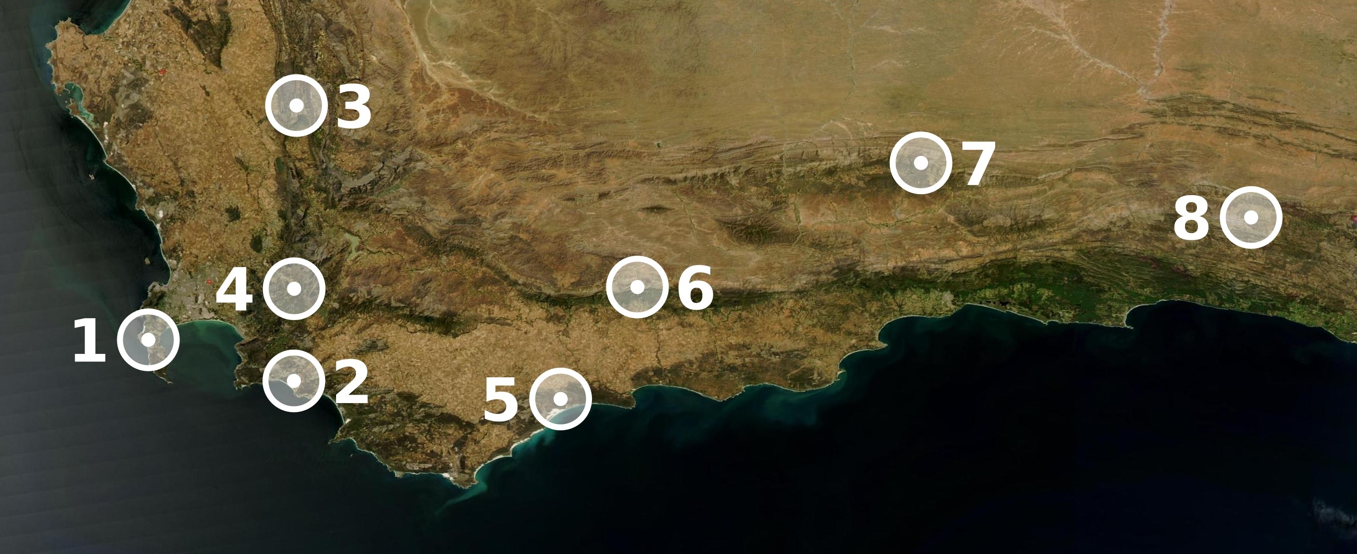
Map showing the location of the eight sites included in UNESCO's World Heritage ensemble Cape Floral Region Protected Areas, in the Cape Floristic Region of the Eastern and Western Cape, in South Africa.
|
| 日付 | |
| 原典 | Map made with The GIMP and Inkscape from a public domain image out of NASA's World Wind. |
| 作者 | Júlio Reis |
ライセンス
このファイルはクリエイティブ・コモンズ 表示-継承 3.0 非移植ライセンスのもとに利用を許諾されています。
- あなたは以下の条件に従う場合に限り、自由に
- 共有 – 本作品を複製、頒布、展示、実演できます。
- 再構成 – 二次的著作物を作成できます。
- あなたの従うべき条件は以下の通りです。
- 表示 – あなたは適切なクレジットを表示し、ライセンスへのリンクを提供し、変更があったらその旨を示さなければなりません。これらは合理的であればどのような方法で行っても構いませんが、許諾者があなたやあなたの利用行為を支持していると示唆するような方法は除きます。
- 継承 – もしあなたがこの作品をリミックスしたり、改変したり、加工した場合には、あなたはあなたの貢献部分を元の作品とこれと同一または互換性があるライセンスの下に頒布しなければなりません。
ファイルの履歴
過去の版のファイルを表示するには、その版の日時をクリックしてください。
| 日付と時刻 | サムネイル | 寸法 | 利用者 | コメント | |
|---|---|---|---|---|---|
| 現在の版 | 2005年11月8日 (火) 23:06 | 2,730 × 1,116 (561キロバイト) | Tintazul | Markers in white instead of red: better visibility, less JPEG artifact | |
| 2005年11月7日 (月) 16:59 | 2,730 × 1,017 (777キロバイト) | Tintazul | {{Information| |Description=Map showing the location of the eight sites included in UNESCO's World Heritage ensemble '''Cape Floral Region Protected Areas'''. |Source=Map made with The GIMP and Inkscape from a public domain image by NASA. |Date=07 Novembe |
ファイルの使用状況
以下のページがこのファイルを使用しています:
グローバルなファイル使用状況
以下に挙げる他のウィキがこの画像を使っています:
- af.wikipedia.org での使用状況
- ast.wikipedia.org での使用状況
- da.wikipedia.org での使用状況
- de.wikipedia.org での使用状況
- es.wikipedia.org での使用状況
- he.wikipedia.org での使用状況
- it.wikipedia.org での使用状況
- nl.wikipedia.org での使用状況
- no.wikipedia.org での使用状況
- pt.wikipedia.org での使用状況
- sv.wikipedia.org での使用状況