
ファイル:Bull Pass - Antarctica.jpg
このプレビューのサイズ: 800 × 600 ピクセル。 その他の解像度: 320 × 240 ピクセル | 640 × 480 ピクセル | 1,024 × 768 ピクセル | 1,280 × 960 ピクセル | 1,600 × 1,200 ピクセル。
元のファイル (1,600 × 1,200 ピクセル、ファイルサイズ: 127キロバイト、MIME タイプ: image/jpeg)
ウィキメディア・コモンズのファイルページにある説明を、以下に表示します。
|
概要
| 解説 |
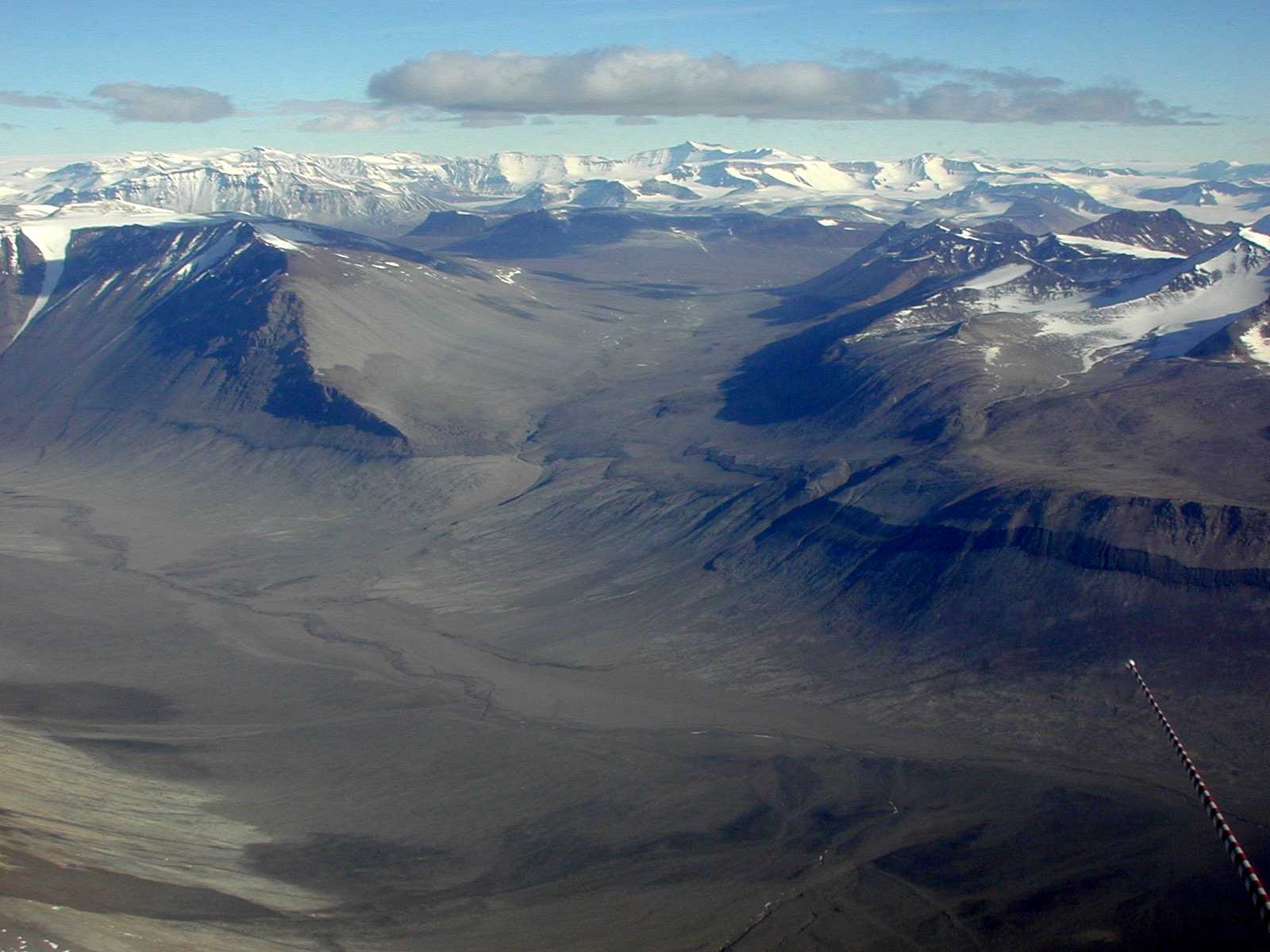
English: Bull Pass in the Dry Valleys of southern Victoria Land. The Dry Valleys extend over 1,500 square miles and are mostly devoid of snow and ice. |
| 日付 | |
| 原典 | Antarctic Photo Library, U.S. Antarctic Program |
| 作者 | NSF/Josh Landis, employee 1999-2001 |
| カメラの位置 | | 以下のサービスでこの位置を確認する: オープンストリートマップ |
|---|
ライセンス
| This image is a work of a National Science Foundation employee, taken or made as part of that person's official duties. As a work of the U.S. federal government, the image is in the public domain. |  |
ファイルの履歴
過去の版のファイルを表示するには、その版の日時をクリックしてください。
| 日付と時刻 | サムネイル | 寸法 | 利用者 | コメント | |
|---|---|---|---|---|---|
| 現在の版 | 2007年3月13日 (火) 19:14 | | 1,600 × 1,200 (127キロバイト) | Eugene van der Pijll | Bull Pass - Antarctica Source: Antarctic Photo Library, U.S. Antarctic Program [http://photolibrary.usap.gov/Portscripts/PortWeb.dll?query&field1=Filename&op1=matches&value=Bullpa1.jpg&catalog=Antarctica&template=USAPgovMidThumbs] Photograph by: Josh La |
ファイルの使用状況
以下のページがこのファイルを使用しています:
グローバルなファイル使用状況
以下に挙げる他のウィキがこの画像を使っています:
- ar.wikipedia.org での使用状況
- ca.wikipedia.org での使用状況
- ceb.wikipedia.org での使用状況
- da.wikipedia.org での使用状況
- de.wikipedia.org での使用状況
- en.wikipedia.org での使用状況
- eo.wikipedia.org での使用状況
- eu.wikipedia.org での使用状況
- he.wikipedia.org での使用状況
- it.wikivoyage.org での使用状況
- lld.wikipedia.org での使用状況
- mk.wikipedia.org での使用状況
- nds.wikipedia.org での使用状況
- nn.wikipedia.org での使用状況
- no.wikipedia.org での使用状況
- pl.wikipedia.org での使用状況
- pt.wikipedia.org での使用状況
- ro.wikipedia.org での使用状況
- ru.wikipedia.org での使用状況
- www.wikidata.org での使用状況