
ファイル:FAA JFK Airport map 2011.svg

この SVG ファイルのこの PNG プレビューのサイズ: 390 × 599 ピクセル. その他の解像度: 156 × 240 ピクセル | 312 × 480 ピクセル | 500 × 768 ピクセル | 667 × 1,024 ピクセル | 1,334 × 2,048 ピクセル | 605 × 929 ピクセル。
元のファイル (SVG ファイル、605 × 929 ピクセル、ファイルサイズ: 1.36メガバイト)
ウィキメディア・コモンズのファイルページにある説明を、以下に表示します。
|

概要
| 解説 |
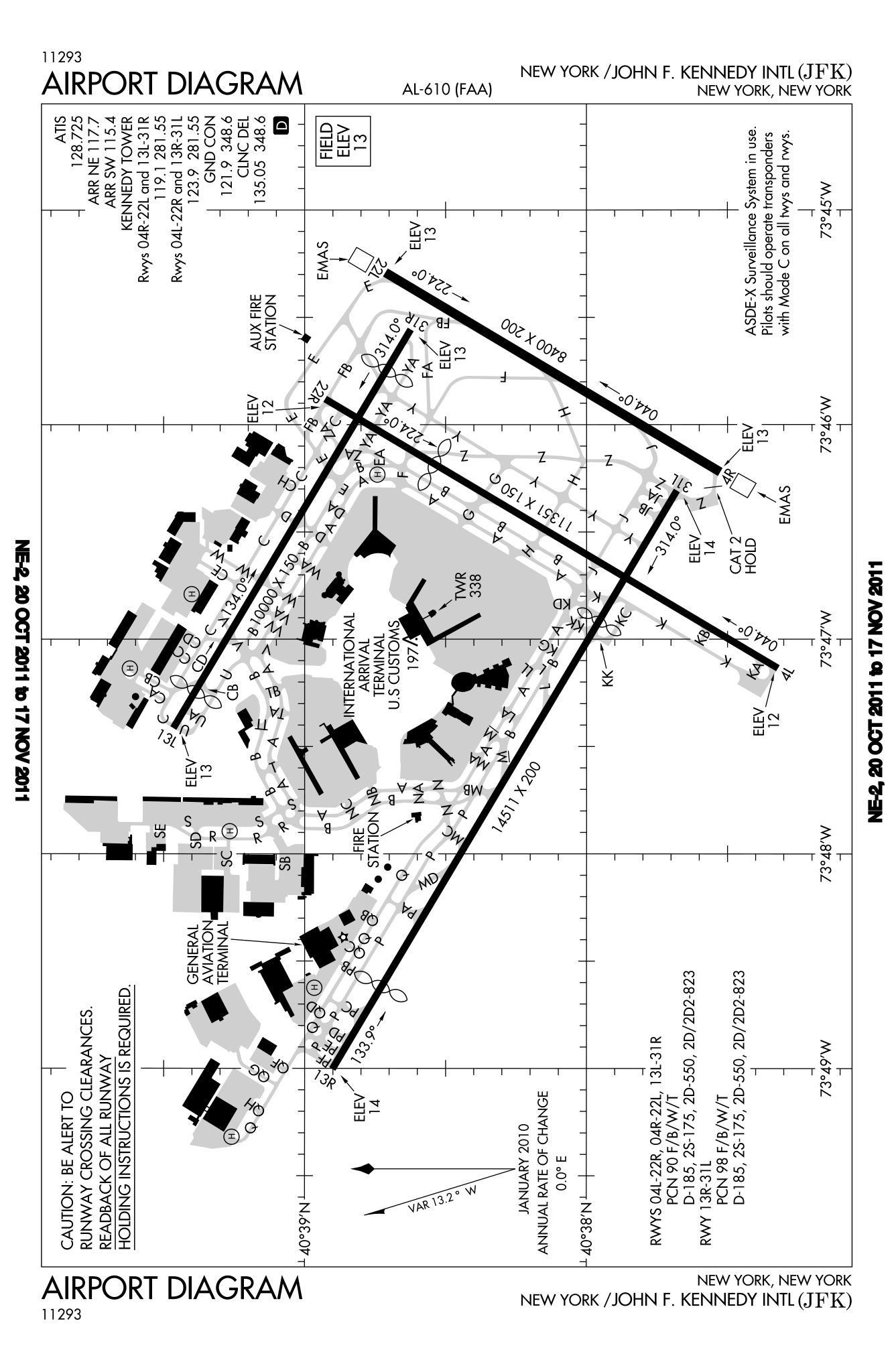
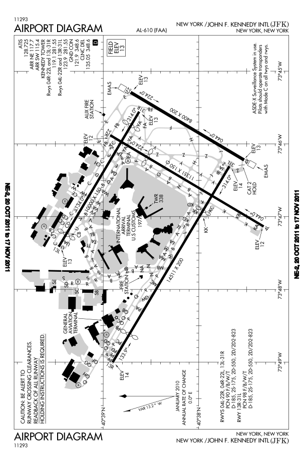
English: FAA diagram for John F. Kennedy International Airport in Queens, New York, United States. |
| 日付 | |
| 原典 |
Website: http://www.avn.faa.gov/digital_tpp.asp Image: http://www.avn.faa.gov/d-tpp/0812/00610AD.PDF (changes every 28 days, see article for current link) |
| 作者 | National Aeronautical Charting Office (NACO), a department of the U.S. Federal Aviation Administration (FAA). |
| 許可 (ファイルの再利用) |
Public Domain |
ライセンス
This image or file is a work of a Federal Aviation Administration employee, taken or made as part of that person's official duties. As a work of the U.S. federal government, the image is in the public domain in the United States.
|
 |
ファイルの履歴
過去の版のファイルを表示するには、その版の日時をクリックしてください。
| 日付と時刻 | サムネイル | 寸法 | 利用者 | コメント | |
|---|---|---|---|---|---|
| 現在の版 | 2011年10月20日 (木) 22:46 | | 605 × 929 (1.36メガバイト) | Bluefist | New version as of October 20, 2011. |
| 2010年3月1日 (月) 21:39 |  | 484 × 743 (709キロバイト) | Atmoz | upload new version | |
| 2008年11月13日 (木) 23:29 |  | 379 × 576 (760キロバイト) | Phongn | {{Information |Description={{en|1=FAA diagram of JFK.}} |Source=http://www.avn.faa.gov/digital_tpp.asp |Author=Federal Aviation Administration |Date= |Permission= |other_versions= }} <!--{{ImageUpload|full}}--> |
ファイルの使用状況
このファイルを使用しているページはありません。
グローバルなファイル使用状況
以下に挙げる他のウィキがこの画像を使っています:
- bn.wikipedia.org での使用状況
- en.wikipedia.org での使用状況
- ko.wikipedia.org での使用状況
- ms.wikipedia.org での使用状況
- ta.wikipedia.org での使用状況
- th.wikipedia.org での使用状況
- uk.wikipedia.org での使用状況