
ファイル:Wappapello Lake Missouri.jpg

このプレビューのサイズ: 800 × 533 ピクセル。 その他の解像度: 320 × 213 ピクセル | 640 × 427 ピクセル | 1,024 × 683 ピクセル | 1,500 × 1,000 ピクセル。
元のファイル (1,500 × 1,000 ピクセル、ファイルサイズ: 520キロバイト、MIME タイプ: image/jpeg)
ウィキメディア・コモンズのファイルページにある説明を、以下に表示します。
|
| 解説 |
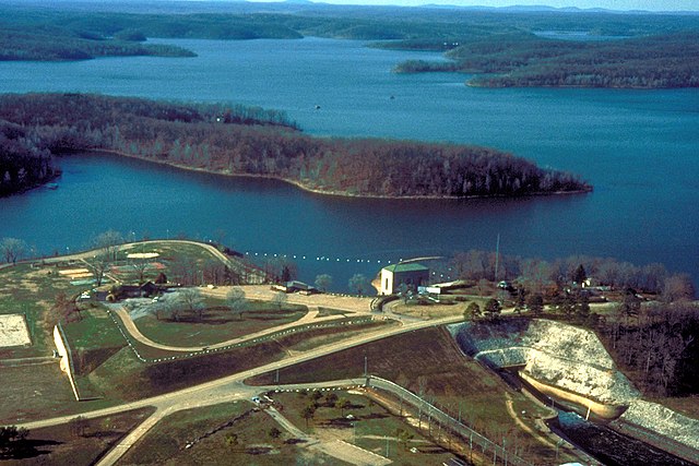
English: Wappapello Lake, near Wappapello, Missouri, USA. The lake is impounded behind Wappapello Dam, of which only the spillway is shown in this photograph. |
|||
| 日付 | not specified or unknown | |||
| 原典 |
U.S. Army Corps of Engineers Digital Visual Library Image page Image description page Digital Visual Library home page |
|||
| 作者 | U.S. Army Corps of Engineers, photographer not specified or unknown | |||
| 許可 (ファイルの再利用) |
|
|||
| 場所 | Wappapello, Wayne County, Missouri, USA |
| カメラの位置 | | 以下のサービスでこの位置を確認する: オープンストリートマップ |
|---|
ファイルの履歴
過去の版のファイルを表示するには、その版の日時をクリックしてください。
| 日付と時刻 | サムネイル | 寸法 | 利用者 | コメント | |
|---|---|---|---|---|---|
| 現在の版 | 2007年4月5日 (木) 02:57 | | 1,500 × 1,000 (520キロバイト) | DanMS | {{Information | Description = {{en|Wappapello Lake, near Wappapello, Missouri, USA. The lake is impounded behind Wappapello Dam, of which only the spillway is shown in this photograph.}} | Source = U.S. Army Corps of Engineers Digital Visual Li |
ファイルの使用状況
以下のページがこのファイルを使用しています:
グローバルなファイル使用状況
以下に挙げる他のウィキがこの画像を使っています:
- ar.wikipedia.org での使用状況
- azb.wikipedia.org での使用状況
- ceb.wikipedia.org での使用状況
- de.wikipedia.org での使用状況
- en.wikipedia.org での使用状況
- fa.wikipedia.org での使用状況
- fr.wikipedia.org での使用状況
- www.wikidata.org での使用状況