
ファイル:Virginia1781 SpencersAndGreenSpring.jpg
このプレビューのサイズ: 587 × 599 ピクセル。 その他の解像度: 235 × 240 ピクセル | 470 × 480 ピクセル | 752 × 768 ピクセル | 1,003 × 1,024 ピクセル | 1,520 × 1,552 ピクセル。
元のファイル (1,520 × 1,552 ピクセル、ファイルサイズ: 986キロバイト、MIME タイプ: image/jpeg)
ウィキメディア・コモンズのファイルページにある説明を、以下に表示します。
|
概要
| 解説 |
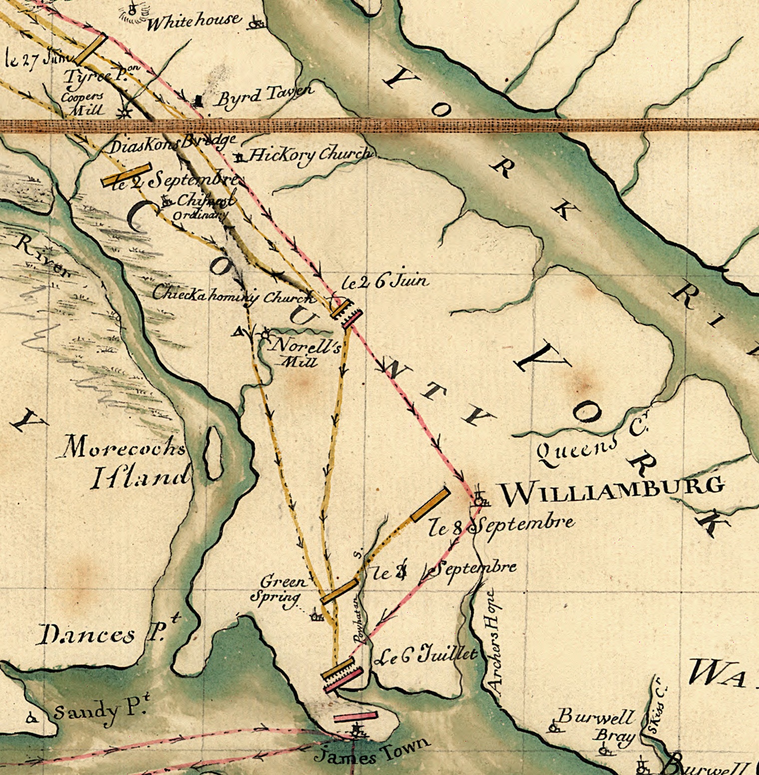
English: Detail of a military prepared by an assistant to the Marquis de Lafayette in 1781. The full map shows the movements of Lafayette and Cornwallis in Virginia during the 1781 Yorktown campaign. This detail shows a portion of the Virginia Peninsula running west and north from Williamsburg; this area was the scene of two battles between the two forces: Battle of Spencer's Ordinary (location labeled "le 26 Juin") and Battle of Green Spring (location labeled "le 6 Juille"). |
||
| 日付 | |||
| 原典 |
|
||
| 作者 | Michel du Chesnoy (1746-1804) |

ライセンス
|
この著作物は、著作権の保護期間が著作者の死後100年以下である国・地域においてパブリックドメインの状態にあります。 | |
| このファイルは著作権法の既知の制約(隣接権や関連する権利を含む)から自由であると特定されています。 | |
ファイルの履歴
過去の版のファイルを表示するには、その版の日時をクリックしてください。
| 日付と時刻 | サムネイル | 寸法 | 利用者 | コメント | |
|---|---|---|---|---|---|
| 現在の版 | 2010年8月6日 (金) 12:25 | | 1,520 × 1,552 (986キロバイト) | Magicpiano | {{Information |Description={{en|Detail of a military prepared by an assistant to the Marquis de Lafayette in 1781. The full map shows the movements of Lafayette and Cornwallis in Virginia during the 1781 Yorktown campaign. This detail shows a portion of |
ファイルの使用状況
以下の 2 ページがこのファイルを使用しています:
グローバルなファイル使用状況
以下に挙げる他のウィキがこの画像を使っています:
- azb.wikipedia.org での使用状況
- ca.wikipedia.org での使用状況
- en.wikipedia.org での使用状況
- www.wikidata.org での使用状況