
ファイル:USACE Claiborne Lock and Dam.jpg

このプレビューのサイズ: 800 × 523 ピクセル。 その他の解像度: 320 × 209 ピクセル | 640 × 419 ピクセル | 1,024 × 670 ピクセル | 1,280 × 837 ピクセル | 1,685 × 1,102 ピクセル。
元のファイル (1,685 × 1,102 ピクセル、ファイルサイズ: 428キロバイト、MIME タイプ: image/jpeg)
ウィキメディア・コモンズのファイルページにある説明を、以下に表示します。
|
| 解説 |
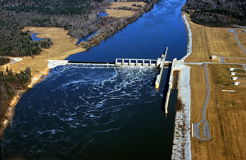
English: Aerial view of Claiborne Lock and Dam on the Alabama River in Monroe County, Alabama, USA. The dam is located approximately 5 miles (8 km) upriver from Claiborne, Alabama. The U.S. Army Corps of Engineers maintains the lock and dam for barge navigation on the river. View is upriver to the north.
Coordinates: 31°36′53.92″N 87°33′2.8″W / 31.6149778°N 87.550778°W |
|||
| 場所 | Monroe County, Alabama, USA | |||
| 日付 | ||||
| 原典 |
U.S. Army Corps of Engineers Digital Visual Library Image page Image description page Digital Visual Library home page |
|||
| 作者 | Adrien Lamarre, U.S. Army Corps of Engineers | |||
| 許可 (ファイルの再利用) |
|
ファイルの履歴
過去の版のファイルを表示するには、その版の日時をクリックしてください。
| 日付と時刻 | サムネイル | 寸法 | 利用者 | コメント | |
|---|---|---|---|---|---|
| 現在の版 | 2007年4月28日 (土) 20:19 | | 1,685 × 1,102 (428キロバイト) | DanMS | {{Information | Description = {{en|Aerial view of Claiborne Lock and Dam on the Alabama River in Monroe County, Alabama, USA. The dam is located approximately 5 miles (8 km) upriver from Claiborne, Alabama. The U.S. Army Corps of Engineers maintains th |
ファイルの使用状況
以下のページがこのファイルを使用しています:
グローバルなファイル使用状況
以下に挙げる他のウィキがこの画像を使っています:
- ar.wikipedia.org での使用状況
- de.wikipedia.org での使用状況
- en.wikipedia.org での使用状況
- fr.wikipedia.org での使用状況
- fy.wikipedia.org での使用状況
- jv.wikipedia.org での使用状況
- xmf.wikipedia.org での使用状況