
ファイル:Taman map.png
高解像度版はありません。
Taman_map.png (452 × 330 ピクセル、ファイルサイズ: 33キロバイト、MIME タイプ: image/png)
ウィキメディア・コモンズのファイルページにある説明を、以下に表示します。
|
概要
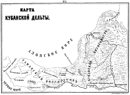
| 解説 | A map of the Taman peninsula. |
| 原典 | From Gerz, K. Arkheologicheskaya topografiya Tamanskogo poluostrova. Moscow: The Moscow Archaeological Society, 1870. |
| 作者 |
ライセンス
This file is a Ukrainian or Ukrainian SSR work and it is presently in the public domain in Ukraine, because it was published before January 1, 1954, and the creator (if known) died before that date (details).
|
 |
|
パブリックドメインの状態にある著作物をウィキメディア・コモンズに置くためには、アメリカ合衆国と著作物の本国の双方において著作権の保護期間が満了している必要があります。この著作物がアメリカ合衆国のものでない場合には、ファイルに対してその本国における著作権状況を示す著作権タグを付加する必要があります。
|
ファイルの履歴
過去の版のファイルを表示するには、その版の日時をクリックしてください。
| 日付と時刻 | サムネイル | 寸法 | 利用者 | コメント | |
|---|---|---|---|---|---|
| 現在の版 | 2007年4月19日 (木) 06:44 | | 452 × 330 (33キロバイト) | Joonasl | {{Information |Description=A map of the Taman peninsula. |Source=From Gerz, K. ''Arkheologicheskaya topografiya Tamanskogo poluostrova.'' Moscow: The Moscow Archaeological Society, 1870. |Date= |Author= |Permission= |other_versions= }} {{PD-Russia}} [[C |
ファイルの使用状況
以下のページがこのファイルを使用しています:
グローバルなファイル使用状況
以下に挙げる他のウィキがこの画像を使っています:
- az.wikipedia.org での使用状況
- bg.wikipedia.org での使用状況
- el.wikipedia.org での使用状況
- en.wikipedia.org での使用状況
- eo.wikipedia.org での使用状況
- es.wikipedia.org での使用状況
- fi.wikipedia.org での使用状況
- fr.wikipedia.org での使用状況
- hi.wikipedia.org での使用状況
- hr.wikipedia.org での使用状況
- hy.wikipedia.org での使用状況
- id.wikipedia.org での使用状況
- it.wikipedia.org での使用状況
- ka.wikipedia.org での使用状況
- la.wikipedia.org での使用状況
- ml.wikipedia.org での使用状況
- mt.wikipedia.org での使用状況
- nn.wikipedia.org での使用状況
- pt.wikipedia.org での使用状況
- ru.wikipedia.org での使用状況
- sh.wikipedia.org での使用状況
- sl.wikipedia.org での使用状況
- sr.wikipedia.org での使用状況
- sv.wikipedia.org での使用状況
- tr.wikipedia.org での使用状況
- uk.wikipedia.org での使用状況