
ファイル:Osmanli Ortadogu.jpg

このプレビューのサイズ: 786 × 600 ピクセル。 その他の解像度: 315 × 240 ピクセル | 629 × 480 ピクセル | 1,006 × 768 ピクセル | 1,280 × 977 ピクセル | 2,560 × 1,954 ピクセル | 7,374 × 5,629 ピクセル。
元のファイル (7,374 × 5,629 ピクセル、ファイルサイズ: 9.42メガバイト、MIME タイプ: image/jpeg)
ウィキメディア・コモンズのファイルページにある説明を、以下に表示します。
|
概要
| 解説 |
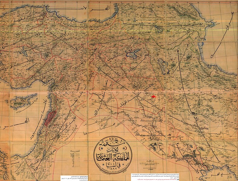
English: An Ottoman-era (1893) map of the Middle East, with the city of Kirkuk highlighted in the Mosul Vilayet
فارسی: بندانگشتی|نقشه منطقه کردستان مربوط به سال ۱۸۹۳ میلادی. که در آن زمان شامل ایالات غربی ایران به همراه ولایات موصل و دیاربکر و وان از امپراتوری عثمانی میشدهاست.
Türkçe: II. Abdülhamit döneminde basılmış Osmanlı Devleti'nin Ortadoğu'daki topraklarını gösteren harita (1893). haritanın tam ortasında کردستان (Kürdistan) kelimesi bulunmaktadır |
| 日付 | |
| 原典 | |
| 作者 | 不明 |
ライセンス
This work first published in the Ottoman Empire is now in the public domain because the Empire's copyright formalities were not met (copyright notice, registration, and deposit), or because the copyright term (30 years after the death of the author, sometimes less) expired before the Empire was dissolved (details).
|
.svg) |
元のアップロードログ
元のファイルページはこちら。以下の利用者は全てku.wikipediaに属します。
- 2007-05-26 08:12 Erdal Ronahi 7374×5629× (9881565 bytes) {{Înformasyon |Şayes=Nexşeya Asyayê |Çavkanî=Arşîvên Osmanî, pukmedia.com |Nûser=Dewleta Osmanî |Dem=1893, di serdema xîlafeta siltan Ebdulhemîd de |Lîsens={{PD-old}} }}
ファイルの履歴
過去の版のファイルを表示するには、その版の日時をクリックしてください。
| 日付と時刻 | サムネイル | 寸法 | 利用者 | コメント | |
|---|---|---|---|---|---|
| 現在の版 | 2009年3月19日 (木) 01:07 | | 7,374 × 5,629 (9.42メガバイト) | KureCewlik81 | {{Information |Description=Anatolien zu Zeit des osmanischen Reiches 1893 |Source= |Date= |Author= |Permission= |other_versions= }} |
ファイルの使用状況
以下のページがこのファイルを使用しています:
グローバルなファイル使用状況
以下に挙げる他のウィキがこの画像を使っています:
- ar.wikipedia.org での使用状況
- azb.wikipedia.org での使用状況
- az.wikipedia.org での使用状況
- ckb.wikipedia.org での使用状況
- de.wikipedia.org での使用状況
- en.wikipedia.org での使用状況
- fa.wikipedia.org での使用状況
- ku.wikipedia.org での使用状況
- mzn.wikipedia.org での使用状況
- ru.wikipedia.org での使用状況
- tr.wikipedia.org での使用状況
- zh.wikipedia.org での使用状況