
ファイル:ONT airport map.PNG
このプレビューのサイズ: 800 × 557 ピクセル。 その他の解像度: 320 × 223 ピクセル | 640 × 446 ピクセル | 1,024 × 713 ピクセル | 1,131 × 788 ピクセル。
元のファイル (1,131 × 788 ピクセル、ファイルサイズ: 101キロバイト、MIME タイプ: image/png)
ウィキメディア・コモンズのファイルページにある説明を、以下に表示します。
|
概要
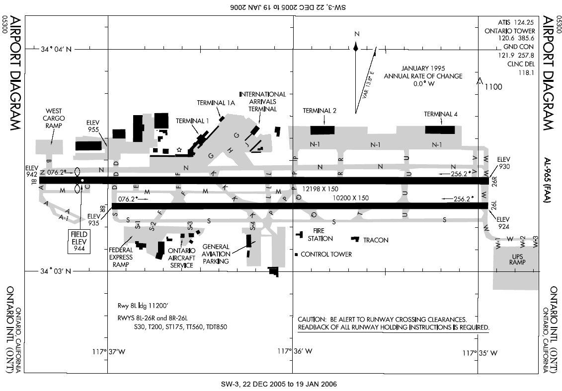
English: Airport diagram for Ontario International Airport.
- Located in Ontario, Inland Empire, Southern California.
This image or file is a work of a Federal Aviation Administration employee, taken or made as part of that person's official duties. As a work of the U.S. federal government, the image is in the public domain in the United States.
|
 |
ファイルの履歴
過去の版のファイルを表示するには、その版の日時をクリックしてください。
| 日付と時刻 | サムネイル | 寸法 | 利用者 | コメント | |
|---|---|---|---|---|---|
| 現在の版 | 2006年1月6日 (金) 22:47 | | 1,131 × 788 (101キロバイト) | Cmprince | Aiport diagram for Ontario International Airport {{PD-USGov-FAA}} |
ファイルの使用状況
以下のページがこのファイルを使用しています:
グローバルなファイル使用状況
以下に挙げる他のウィキがこの画像を使っています:
- af.wikipedia.org での使用状況
- cs.wikipedia.org での使用状況
- de.wikipedia.org での使用状況
- en.wikipedia.org での使用状況
- es.wikipedia.org での使用状況
- fr.wikipedia.org での使用状況
- id.wikipedia.org での使用状況
- mr.wikipedia.org での使用状況
- pl.wikipedia.org での使用状況
- ur.wikipedia.org での使用状況
- zh.wikipedia.org での使用状況