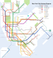
ファイル:NYC subway-4D.svg

この SVG ファイルのこの PNG プレビューのサイズ: 512 × 553 ピクセル. その他の解像度: 222 × 240 ピクセル | 444 × 480 ピクセル | 711 × 768 ピクセル | 948 × 1,024 ピクセル | 1,896 × 2,048 ピクセル。
元のファイル (SVG ファイル、512 × 553 ピクセル、ファイルサイズ: 2.63メガバイト)
ファイルの履歴
過去の版のファイルを表示するには、その版の日時をクリックしてください。
| 日付と時刻 | サムネイル | 寸法 | 利用者 | コメント | |
|---|---|---|---|---|---|
| 現在の版 | 2022年12月8日 (木) 04:39 |  | 512 × 553 (2.63メガバイト) | TFSyndicate | Added more 'accessible station' symbols |
| 2021年11月16日 (火) 17:36 |  | 512 × 553 (2.63メガバイト) | TFSyndicate | Additional minor revisions | |
| 2021年11月16日 (火) 17:32 |  | 512 × 553 (2.65メガバイト) | TFSyndicate | Revised to include new station names, new part-time transfer at Times Square, and rush hour express and extension. | |
| 2019年2月24日 (日) 14:40 |  | 2,500 × 2,700 (3.66メガバイト) | Dream out loud | fixed code to pass W3 validation, removed random floating text, removed water background border, redrew Brooklyn/Queens border based on official map, reshaped Rockaway Peninsula, reshaped Staten Island | |
| 2018年9月19日 (水) 15:16 |  | 2,500 × 2,700 (3.72メガバイト) | PrecipiceofDuck | Updated with opening of WTC Cortlandt and N train stopping at 45 St and 53 St | |
| 2018年5月29日 (火) 11:45 |  | 2,500 × 2,700 (3.65メガバイト) | Dream out loud | fixed AirTrain JFK name and stations | |
| 2018年2月2日 (金) 01:47 |  | 2,500 × 2,700 (3.73メガバイト) | PrecipiceofDuck | Updated to correct 2 spelling errors, and to reflect ADA accessibility at Ozone Park-Lefferts Blvd and ADA accessibility/connection between World Trade Center E and Cortlandt St R/W | |
| 2017年1月21日 (土) 04:54 |  | 2,500 × 2,700 (3.72メガバイト) | PrecipiceofDuck | Updated with opening of Arthur Kill station on the SIR and ADA accessibility at 23 St on the Lexington Av line, also delisting the limited rush hour services | |
| 2017年1月2日 (月) 00:36 |  | 2,500 × 2,700 (3.75メガバイト) | PrecipiceofDuck | Updated with 2nd Ave line and other small changes | |
| 2016年1月16日 (土) 13:49 |  | 2,500 × 2,700 (2.83メガバイト) | CountZ | Updated to reflect 24-hour J service in Lower Manhattan |
ファイルの使用状況
以下の 7 ページがこのファイルを使用しています:
グローバルなファイル使用状況
以下に挙げる他のウィキがこの画像を使っています:
- ar.wikipedia.org での使用状況
- az.wikipedia.org での使用状況
- ba.wikipedia.org での使用状況
- be-tarask.wikipedia.org での使用状況
- be.wikipedia.org での使用状況
- bg.wikipedia.org での使用状況
- bn.wikipedia.org での使用状況
- ca.wikipedia.org での使用状況
- crh.wikipedia.org での使用状況
- cv.wikipedia.org での使用状況
- de.wikipedia.org での使用状況
- el.wikipedia.org での使用状況
- el.wikivoyage.org での使用状況
- en.wikipedia.org での使用状況
- New York City Subway
- Proposed expansion of the New York City Subway
- Wikipedia:WikiProject Trains
- New York City Subway stations
- Topological map
- User talk:CountZ
- Transit map
- Portal:Technology/Selected pictures
- Wikipedia:Featured pictures/Diagrams, drawings, and maps/Maps
- Portal:New York City/Selected picture/Archives
- Wikipedia:Graphics Lab/Resources/Draw topological maps
- Wikipedia:Featured pictures thumbs/20
- List of New York City Subway stations in the Bronx
- Wikipedia:Featured picture candidates/New York subway diagram
- Wikipedia:Featured picture candidates/October-2009
- Wikipedia:Wikipedia Signpost/2009-10-05/Features and admins
- List of New York City Subway stations in Manhattan
- List of New York City Subway stations in Brooklyn
- List of New York City Subway stations in Queens
- Wikipedia:WikiProject United States/Recognized content
- Wikipedia talk:WikiProject New York City Public Transportation/Archive 14
- Wikipedia:WikiProject United States/Quality content
- Wikipedia:Picture of the day/March 2011
- Template:POTD/2011-03-18
- Wikipedia:Main Page history/2011 March 18
- Wikipedia talk:WikiProject New York City Public Transportation/Archive 16
- Talk:New York City Subway/Archive 3
- Portal:New York City/Selected picture/19
- Wikipedia talk:WikiProject New York City Public Transportation/Archive 17
- Wikipedia:Wikipedia Signpost/2009-10-05/SPV
- Talk:New York City Subway stations/sandbox
- User:Another Believer/Travel/United States
- List of New York City Subway stations
- Wikipedia:WikiProject Trains/Featured content
このファイルのグローバル使用状況を表示する。


