
ファイル:Indian Rebellion of 1857.jpg

このプレビューのサイズ: 713 × 599 ピクセル。 その他の解像度: 286 × 240 ピクセル | 571 × 480 ピクセル | 914 × 768 ピクセル | 1,218 × 1,024 ピクセル | 1,959 × 1,647 ピクセル。
元のファイル (1,959 × 1,647 ピクセル、ファイルサイズ: 2.82メガバイト、MIME タイプ: image/jpeg)
ウィキメディア・コモンズのファイルページにある説明を、以下に表示します。
|
概要
| 記述 |
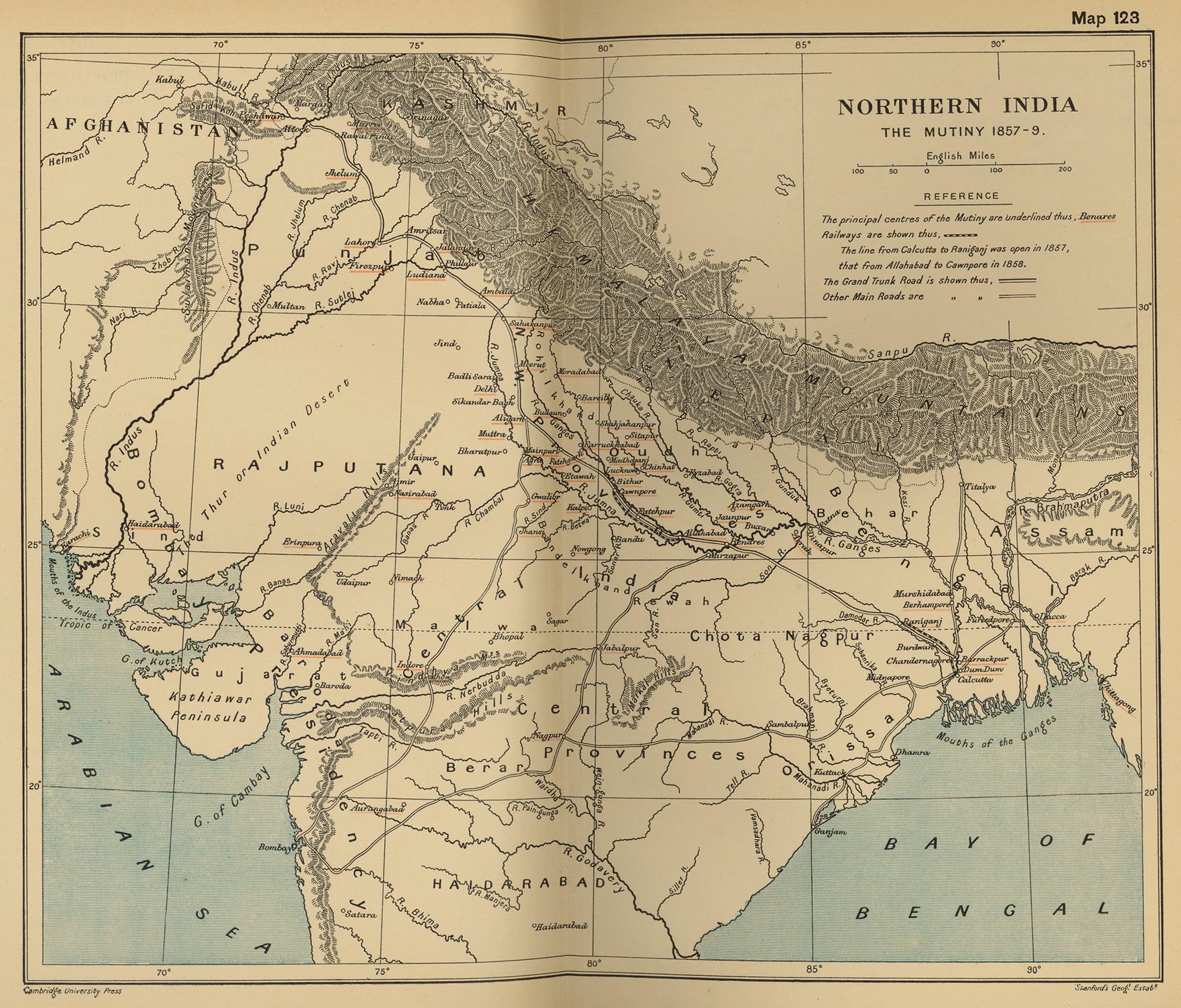
English: Map, "North India: The Mutiny 1857-9" from "The Cambridge Modern History Atlas". Cambridge University Press; London. 1912.
Editors were Sir Adolphus William Ward (†1924), G.W. Prothero (†1922), and Sir Stanley Mordaunt Leathes (†1938). Individual authors of works making up the atlas are not identified, nor are the likely to be, after reasonable research. Español: Mapa del norte de India |
|||||||||
| 日付 | ||||||||||
| 原典 | Perry-Castañeda Library Map Collection Website. | |||||||||
| 作者 |
不明 Cambridge University Press; Stanford's Geogl. Estabt.. |
|||||||||
| Geotemporal data | ||||||||||
| Bounding box |
|
|||||||||
| Georeferencing | ||||||||||
| その他のバージョン |
|
|||||||||

ライセンス
|
このファイルは、パブリックドメインの状態にある平面的な美術の著作物を写真術によって忠実に複製したものです。このような複製はアメリカ合衆国においてパブリックドメインの状態にあります。その他の地域では再利用に制限がかかる場合があります。詳しくはReuse of PD-Art photographsをご覧ください。美術の著作物としての原図は、次の理由によりパブリックドメインの状態にあります。
| ||||
元のアップロードログ
The original description page was on en.wikipedia (file log). All following user names refer to en.wikipedia.
- 2010-06-06 08:35 PawełMM 1959×1647× (1118753 bytes) vertical strip shadorws removed
- 2010-06-05 12:13 PawełMM 1959×1647× (1201791 bytes) central verticaly part flattened, cropped
- 2008-03-05 02:51 Fowler&fowler 1992×1700× (683065 bytes) Map, "North India: The Mutiny 1857-9" from "The Cambridge Modern History Atlas" edited by Sir Adolphus William Ward, G.W. Prothero, Sir Stanley Mordaunt Leathes, and E.A. Benians. Cambridge University Press; London. 1912. Downloaded by ~~~~ from the [h
- 2008-03-05 02:37 Fowler&fowler 1992×1700× (715404 bytes) Map, "North India: The Mutiny 1857-9" from "The Cambridge Modern History Atlas" edited by Sir Adolphus William Ward, G.W. Prothero, Sir Stanley Mordaunt Leathes, and E.A. Benians. Cambridge University Press; London. 1912. Downloaded by ~~~~ from the [h
ファイルの履歴
過去の版のファイルを表示するには、その版の日時をクリックしてください。
| 日付と時刻 | サムネイル | 寸法 | 利用者 | コメント | |
|---|---|---|---|---|---|
| 現在の版 | 2012年9月11日 (火) 15:35 | | 1,959 × 1,647 (2.82メガバイト) | Yann | color balance, contrast, color corrections |
| 2010年10月18日 (月) 07:45 |  | 1,959 × 1,647 (1.07メガバイト) | File Upload Bot (Magnus Manske) | {{BotMoveToCommons|en.wikipedia|year={{subst:CURRENTYEAR}}|month={{subst:CURRENTMONTHNAME}}|day={{subst:CURRENTDAY}}}} {{Information |Description={{en|Map, "North India: The Mutiny 1857-9" from "The Cambridge Modern History Atlas" edited by Sir Adolphus |
ファイルの使用状況
以下のページがこのファイルを使用しています:
グローバルなファイル使用状況
以下に挙げる他のウィキがこの画像を使っています:
- ar.wikipedia.org での使用状況
- ast.wikipedia.org での使用状況
- azb.wikipedia.org での使用状況
- bg.wikipedia.org での使用状況
- bh.wikipedia.org での使用状況
- bn.wikipedia.org での使用状況
- br.wikipedia.org での使用状況
- cs.wikipedia.org での使用状況
- cy.wikipedia.org での使用状況
- en.wikipedia.org での使用状況
- es.wikipedia.org での使用状況
- fr.wikipedia.org での使用状況
- hi.wikipedia.org での使用状況
- id.wikipedia.org での使用状況
- io.wikipedia.org での使用状況
- ka.wikipedia.org での使用状況
- lv.wikipedia.org での使用状況
- mai.wikipedia.org での使用状況
- mr.wikipedia.org での使用状況
- ms.wikipedia.org での使用状況
- ne.wikipedia.org での使用状況
- or.wikipedia.org での使用状況
- pa.wikipedia.org での使用状況
- pl.wikipedia.org での使用状況
- pnb.wikipedia.org での使用状況
- ru.wikipedia.org での使用状況
- sd.wikipedia.org での使用状況
- simple.wikipedia.org での使用状況
- sr.wikipedia.org での使用状況
- sv.wikipedia.org での使用状況
- ta.wikipedia.org での使用状況
- te.wikipedia.org での使用状況
- th.wikipedia.org での使用状況
- tr.wikipedia.org での使用状況
- ur.wikipedia.org での使用状況
このファイルのグローバル使用状況を表示する。