ファイル:BlankMap-World.svg
ページのコンテンツが他言語でサポートされていません。

元のファイル(SVG ファイル、2,754 × 1,398 ピクセル、ファイルサイズ: 1.05メガバイト)

Notice
English: Editor's note:
  • This map is saved in human-editable plain text format. Please do not upload edits directly saved with Inkscape.
  • When making a 二次著作物, it is better to keep the Earth's outline, and consider using a properly centered map with a proper projection when making a regional map. See the discussion.
  • When you upload a new version of this file, you irrevocably agree to release your modified version to the public domain. If you do not agree to release your modified version to the public domain, you may upload it as a new file and license it under the free license you want.
Русский: Примечание редактора:
  • Эта географическая карта сохранена в текстовом формате, удобном для чтения человеком. Пожалуйста, не загружайте версий этого файла, сохранённых графическим редактором Inkscape или ему подобными, без приведения их в такой же человеко-читаемый формат.
  • При создании производной карты на основе этого изображения, рекомендуется сохранить контур Земли, а при создании региональных карт — позаботиться о правильной центровке и правильной проекции (подробнее см. обсуждение (англ.)).
  • Если Вы загружаете новую версию этого файла, Вы тем самым соглашаетесь на безотзывную передачу загруженного Вами изображения в общественное достояние, на тех же условиях, на которых были опубликованы все предыдущие версии этого файла. Если Вы не согласны на такие условия публикации, Вы можете загрузить Вашу работу на Викисклад как новый файл и выбрать другую свободную лицензию.
Notice
English: Note on boundaries: the map contains coding for various disputed sovereignty claims:

These classes can be changed in derivative maps by using CSS (see File_talk:BlankMap-World.svg#Selecting_and_colouring_countries on how to do that), but repeated overwriting of this file against established consensus might fall into COM:UPLOADWAR category and result in block.

See instructions page for more details.
Русский: Примечание по территориям: карта содержит в себе коды для территорий с нечётким правовым статусом, а именно:

Стандартное поведение этих территорий может, в производных работах, быть переопределено с помощью соответствующих CSS-классов (см. инструкцию (англ.), как это можно сделать), однако настойчивая перезапись данного файла вопреки устоявшемуся консенсусу может быть расценена как война загрузок и привести к блокировке.

См. подробнее в документации файла (на англ.)


この画像は常に最新のものであることが求められます。必要に応じて自由に更新してください。
このファイルは、最新の情報を受けて更新される可能性があります。
新しい更新が反映されることなく、特定の版のファイルを使用したい場合は、必要な版を別のファイルとしてアップロードしてください。

概要

解説
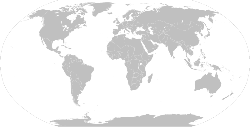
English: A detailed Robinson projection SVG map with grouping enabled to connect all non-contiguous parts of a country's territory for easy coloring. Smaller countries can also be represented by larger circles to show their data more clearly. A thorough description of use and other instructions relating to this can be found on the instructions page.
Русский: Современная политическая карта мира (бланк) в проекции Робинсона, сохранённая в векторном формате SVG, в котором территориально-разделённые части государств (острова, анклавы, заморские владения и другие) сгруппированы вместе — и таким образом легко окрашивать всю группу одним цветом. Малые страны, не отображающиеся или отображающиеся слишком мелко на карте мира в таком масштабе, на производных картах могут быть также отображены в виде кругов (на этой карте круги присутствуют в виде прозрачных невидимых элементов изображения). Более подробное описание и рекомендации по использованию смотрите в документации файла (англ.).
日付 2006年11月12日 (当初のアップロード日)
原典 Adapted from File:"Political World" CIA World Factbook map 2005.svg which was originally based on CIA's 2005 political world map (a vector-based PDF file which can now be found in Perry–Castañeda Library Map Collection).
作者 Canuckguy (talk) and many others (see File history)
許可
(ファイルの再利用)
Public domain この著作物の著作権者である私は、この著作物における権利を放棄しパブリックドメインとします。これは全世界で適用されます。
一部の国では、これが法的に可能ではない場合があります。その場合は、次のように宣言します。
私は、あらゆる人に対して、法により必要とされている条件を除き、如何なる条件も課すことなく、あらゆる目的のためにこの著作物を使用する権利を与えます。
その他のバージョン

このファイルの派生的著作物:

SVG 開発
InfoField
 
このSVGのソースコードは正しい
 
このベクターイメージInkscape で作成され、テキストエディタで編集されました
地図 is saved in human-editable plain text format. Any editing of the image or creation of any derivative work should be performed using a text editor. Please do not upload edits saved or exported with Inkscape or similar vector graphics editors, as well as with automated tools such as SVG Translate.
Blank maps of the world for historical use
pre-1800

1 · 820 · 1500 · 1710


19th century

1840 · 1861 · 1866 · 1872 · 1898


20th century

1902 · 1912 · 1914 · WWI · Aug 1918 · 1920 · 1921 · 1924 · 1926 · 1935 · 1937 · Mar 1938 · Oct 1938 · Mar 1939 · Oct 1939 · WWII · Nov 1942 · May 1945 · 1957 · 1959 · 1962 · 1968 · 1970 · 1985 · 1990 · 1993


21st century

2000 · 2005 · 2007 · 2009 · Current

(this template: · view · discuss )

キャプション

このファイルの内容を1行で記述してください

このファイルに描写されている項目

題材

ファイルの履歴

過去の版のファイルを表示するには、その版の日時をクリックしてください。

(最新 | 最古) (以後の10件 | ) (10 | 20 | 50 | 100 | 250 | 500 件) を表示
日付と時刻サムネイル寸法利用者コメント
現在の版2021年8月14日 (土) 09:252021年8月14日 (土) 09:25時点における版のサムネイル2,754 × 1,398 (1.05メガバイト)Seryo93Reverted to version as of 23:50, 11 August 2021 (UTC) messed-up again
2021年8月12日 (木) 15:572021年8月12日 (木) 15:57時点における版のサムネイル2,754 × 1,398 (1.05メガバイト)FlacksevenReverted to version as of 14:41, 8 August 2021 (UTC)
2021年8月11日 (水) 23:502021年8月11日 (水) 23:50時点における版のサムネイル2,754 × 1,398 (1.05メガバイト)Cherkashusing a 2-letter abbreviation (xr) for Kuril, just like the rest of them
2021年8月8日 (日) 17:142021年8月8日 (日) 17:14時点における版のサムネイル2,754 × 1,398 (1.05メガバイト)Seryo93changed Southern Kurile caption to match File:World_map_configurable.svg
2021年8月8日 (日) 17:002021年8月8日 (日) 17:00時点における版のサムネイル2,754 × 1,398 (1.05メガバイト)Seryo93+xsq class for the w:Kuril Islands dispute, following general scheme (grouped into controlling Russia)
2021年8月8日 (日) 16:272021年8月8日 (日) 16:27時点における版のサムネイル2,754 × 1,398 (1.05メガバイト)Seryo93Reverted to version as of 05:55, 8 August 2021 (UTC) see documentation and compare with Golans (internationally recognised as Syrian, yet grouped into Israel by default)
2021年8月8日 (日) 14:412021年8月8日 (日) 14:41時点における版のサムネイル2,754 × 1,398 (1.05メガバイト)FlacksevenReverted to version as of 18:04, 7 August 2021 (UTC). Crimea must be connected to Ukraine. It cannot be on same layer with Russia by default.
2021年8月8日 (日) 05:552021年8月8日 (日) 05:55時点における版のサムネイル2,754 × 1,398 (1.05メガバイト)Seryo93The map must be customisable
2021年8月7日 (土) 18:042021年8月7日 (土) 18:04時点における版のサムネイル2,754 × 1,398 (1.05メガバイト)FlacksevenReverted to version as of 22:47, 6 August 2021 (UTC). It is enough for pro-Russian users to edit the affiliation of Crimea. There should be no two classes, because Crimea must be inseparable with Ukraine, as it was before 2014. The map can be used by other people through search and can lead to a misconception about the affiliation of Crimea when they want to colorize and use it elsewhere..
2021年8月7日 (土) 06:372021年8月7日 (土) 06:37時点における版のサムネイル2,754 × 1,398 (1.05メガバイト)Seryo93Reverted to version as of 16:36, 6 August 2021 (UTC) enough is enough, although Crimea is in a need for a solution. Maybe add it to both classes somehow?
(最新 | 最古) (以後の10件 | ) (10 | 20 | 50 | 100 | 250 | 500 件) を表示

以下の​ 2 ページがこのファイルを使用しています:

グローバルなファイル使用状況

以下に挙げる他のウィキがこの画像を使っています:

このファイルのグローバル使用状況を表示する。

メタデータ