
ファイル:Location of Mount St. Helens.png
このプレビューのサイズ: 749 × 599 ピクセル。 その他の解像度: 300 × 240 ピクセル | 600 × 480 ピクセル | 1,001 × 801 ピクセル。
元のファイル (1,001 × 801 ピクセル、ファイルサイズ: 1.8メガバイト、MIME タイプ: image/png)
ウィキメディア・コモンズのファイルページにある説明を、以下に表示します。
|
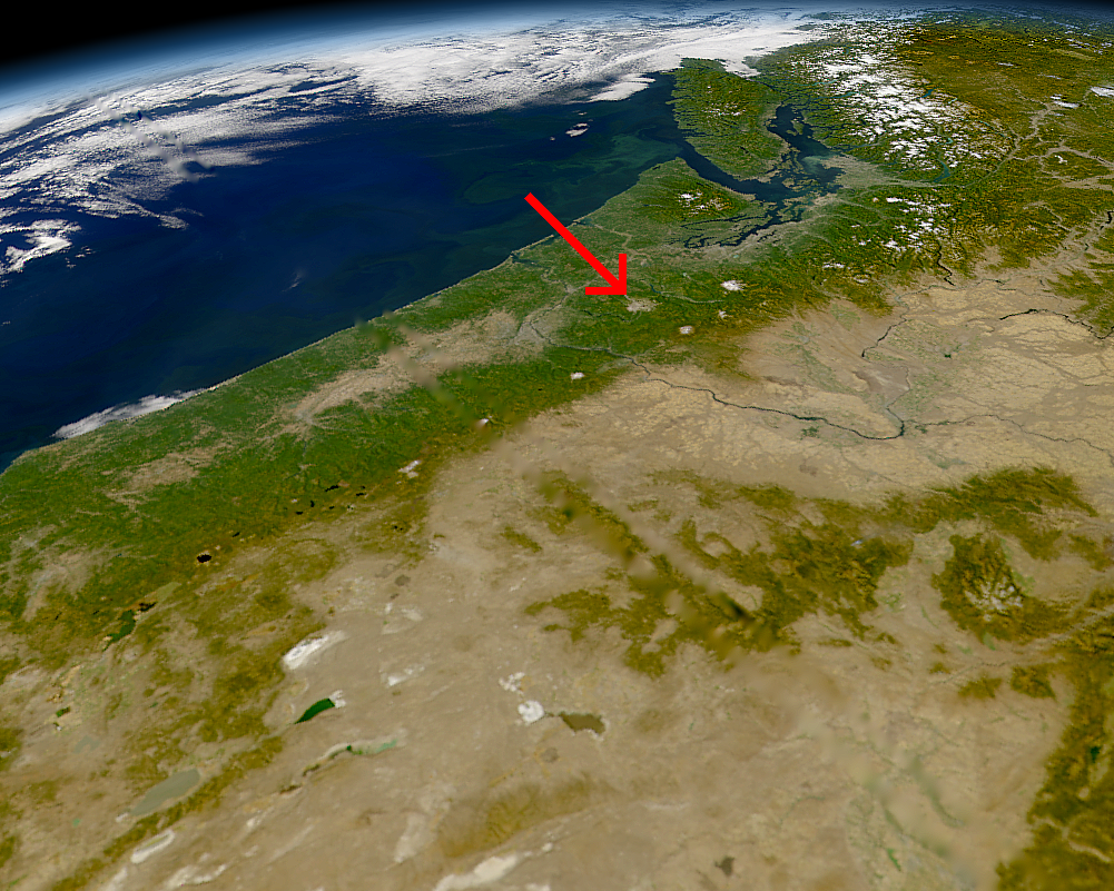
Location of Mount St. Helens, Washington.
NASA Photo, courtesy "NASA Earth From Space" Website; Modified with text by USGS/CVO.[1]
| This image is from the Sea-viewing Wide Field-of-view Sensor (SeaWiFS) Project and more than 5 years old.
Satellite data captured by the SeaWIFS sensor are released into the public domain 5 years after capture. Data less than five years old can be re-used only for educational or scientific purposes; any commercial use of such images must be coordinated with GeoEye. [2] |
| This work has been released into the public domain by its copyright holder, GeoEye. This applies worldwide. 一部の国では、これが法的に可能ではない場合があります。その場合は、次のように宣言します。 GeoEyeは、あらゆる人に対して、法により必要とされている条件を除き、如何なる条件も課すことなく、あらゆる目的のためにこの著作物を使用する権利を与えます。
|
- Sensor
- OrbView-2/SeaWiFS
- Datastart
- 2000-09-26
- Visible Earth v1 ID
- 4786
- Visualization Date
- 2000-09-26
http://visibleearth.nasa.gov/view_rec.php?vev1id=4786[dead link]
relation
ファイルの履歴
過去の版のファイルを表示するには、その版の日時をクリックしてください。
| 日付と時刻 | サムネイル | 寸法 | 利用者 | コメント | |
|---|---|---|---|---|---|
| 現在の版 | 2005年8月9日 (火) 07:27 | | 1,001 × 801 (1.8メガバイト) | Complex01 | Location of Mount St. Helens, Washington, September 1994. NASA Photo, courtesy "NASA Earth From Space" Website; Modified with text by USGS/CVO.[http://vulcan.wr.usgs.gov/Volcanoes/MSH/Images/annotated_nasa_images.html] {{PD-USGov-Interior-USGS}} {{PD- |
ファイルの使用状況
以下のページがこのファイルを使用しています: