
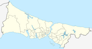
ファイル:Turkey Istanbul location map.svg

元のファイル (SVG ファイル、1,568 × 845 ピクセル、ファイルサイズ: 424キロバイト)
ウィキメディア・コモンズのファイルページにある説明を、以下に表示します。
|
概要
| 解説 |
Geographische Begrenzung der Karte:
Geographic limits of the map:
|
| 日付 | |
| 原典 |
次のものを使用した投稿者自身による著作物:: File:Istanbul location districts.svg by |
| 作者 | NordNordWest |

|
この地図は、ドイツ語版の(地図研究室)で制作、もしくは改善されたものです。更なる改善の為、地図を提案することもできます。
|
ライセンス
Usage of this file with:

explanatory notes: Legally binding is only the full legalcode. For a free usage I recommend to respect the following licence conditions:
1. Provide my name as given above: NordNordWest,
2. a copy of, or the URI for, the applicable license: https://creativecommons.org/licenses/by-sa/3.0/de/legalcode,
3. the title of the work,
4. in the case of an adaptation, a credit identifying the use of the work in the adaptation.
This license and the rights granted hereunder will terminate automatically upon any breach by you of the terms of this license. Any of the above conditions can be waived if you get permission from the copyright holder. If you have questions or wish differing conditions, please contact me through nnwest or my discussion page ![]() t-online.de
t-online.de
- あなたは以下の条件に従う場合に限り、自由に
- 共有 – 本作品を複製、頒布、展示、実演できます。
- 再構成 – 二次的著作物を作成できます。
- あなたの従うべき条件は以下の通りです。
- 表示 – あなたは適切なクレジットを表示し、ライセンスへのリンクを提供し、変更があったらその旨を示さなければなりません。これらは合理的であればどのような方法で行っても構いませんが、許諾者があなたやあなたの利用行為を支持していると示唆するような方法は除きます。
- 継承 – もしあなたがこの作品をリミックスしたり、改変したり、加工した場合には、あなたはあなたの貢献部分を元の作品とこれと同一または互換性があるライセンスの下に頒布しなければなりません。

ファイルの履歴
過去の版のファイルを表示するには、その版の日時をクリックしてください。
| 日付と時刻 | サムネイル | 寸法 | 利用者 | コメント | |
|---|---|---|---|---|---|
| 現在の版 | 2018年4月6日 (金) 17:26 | | 1,568 × 845 (424キロバイト) | NordNordWest | upd |
| 2014年8月16日 (土) 11:37 |  | 1,568 × 845 (465キロバイト) | NordNordWest | == {{int:filedesc}} == {{Information |Description= {{de|Positionskarte der Provinz Istanbul, Türkei}} Geographische Begrenzung der Karte: * N: 41.619888° N * S: 40.796666° N * W: 27.941666° O * O: 29.97388... |
ファイルの使用状況
以下の 13 ページがこのファイルを使用しています:
グローバルなファイル使用状況
以下に挙げる他のウィキがこの画像を使っています:
- ar.wikipedia.org での使用状況
- azb.wikipedia.org での使用状況
- az.wikipedia.org での使用状況
- Ayasofiya
- Topqapı sarayı
- Əyyub Sultan məscidi
- Sultan Əhməd məscidi
- Zal Mahmud paşa məscidi
- Ulduz sarayı
- Laləli məscidi
- Yavuz Sultan Səlim külliyəsi
- Bəyazid məscidi
- İbrahim Paşa Sarayı
- Ulduz Saat Qülləsi
- Abdi İpəkçi sui-qəsdi
- Rumeli Hasarı
- Yeni məscid (İstanbul)
- Mehrimah Sultan məscidi (Üsküdar)
- Haseki hamamı
- Ağa hamamı
- Dolmabağça saat qülləsi
- Topxana saat qülləsi
- Nuruosmaniyə məscidi
- Atatürk körpüsü
- Yeddiqüllə zindanları
- İstanbul Əşkinazi sinaqoqu
- Küçüksu sarayı
- Hidiv qəsri
- Səbətçilər sarayı
- İhlamur sarayı
- Florya Atatürk Dəniz Köşkü
- Çırağan sarayı
- Şablon:Yer xəritəsi Türkiyə İstanbul
- Fateh məscidi (İstanbul)
- Kiçik Vlaxerna sarayı
- İstanbul Hava Limanı
- Lütfü Kırdar Konqres və Sərgi Sarayı (İstanbul)
- Ulduz Həmidiyyə məscidi
- Böyük İstanbul avtovağzalı
- Türkiyə Super Liqası 2021/2022
- Türkiyə Super Liqası 2020/2021
- Türkiyə Super Liqası 2019/2020
- Türkiyə Super Liqası 2018/2019
- bn.wikipedia.org での使用状況
このファイルのグローバル使用状況を表示する。