
ファイル:Tectonic plates hotspots-en.svg

この SVG ファイルのこの PNG プレビューのサイズ: 800 × 547 ピクセル. その他の解像度: 320 × 219 ピクセル | 640 × 437 ピクセル | 1,024 × 700 ピクセル | 1,280 × 874 ピクセル | 2,560 × 1,749 ピクセル | 1,092 × 746 ピクセル。
元のファイル (SVG ファイル、1,092 × 746 ピクセル、ファイルサイズ: 898キロバイト)
ウィキメディア・コモンズのファイルページにある説明を、以下に表示します。
|
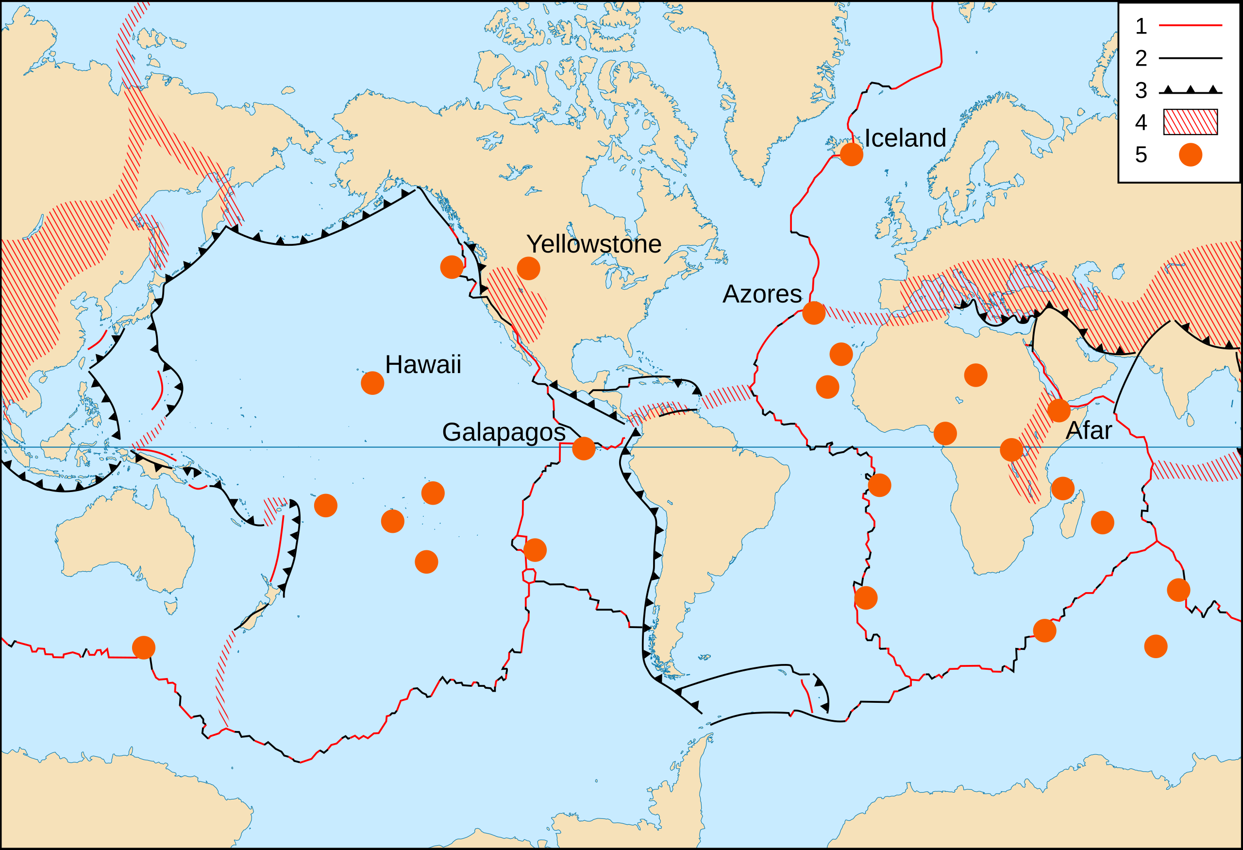
概要
- Key :
- 1 : Divergent plate boundaries ;
- 2 : Transform plate boundaries ;
- 3 : Convergent plate boundaries ;
- 4 : Plate boundary zones ;
- 5 : Selected prominent hotspots.
| 解説 |
English: World map in English of selected prominent geological hotspots.
Français : Carte en anglais des principaux points chauds géologiques mondiaux. |
| 日付 | 2006-10, upgraded 2015-09 |
| 原典 |
|
| 作者 | Eric Gaba (Sting - fr:Sting) |
| 許可 (ファイルの再利用) |
Public domain |
| その他のバージョン |
このファイルの派生的著作物:
|


ライセンス
この画像およびメディアは、アメリカ合衆国内務省の実務機関であるアメリカ地質調査所に属する者が職務上作成した著作物のみで構成されているため、アメリカ合衆国国内でパブリックドメインの状態にあります。詳細についてはUSGSの著作物に関する取扱い(英語)をご覧ください。
|
| This work was previously under Public Domain, or a Free License. It has been digitally enhanced and/or modified. This derivative work has been (or is hereby) released into the public domain by its author, Sting at the French Wikipedia project. This applies worldwide. In some countries this is not legally possible; if so:
|
ファイルの履歴
過去の版のファイルを表示するには、その版の日時をクリックしてください。
| 日付と時刻 | サムネイル | 寸法 | 利用者 | コメント | |
|---|---|---|---|---|---|
| 現在の版 | 2015年9月6日 (日) 21:17 | | 1,092 × 746 (898キロバイト) | Sting | Upgraded background map using NGDC WCL data |
| 2008年6月2日 (月) 21:38 |  | 1,100 × 750 (373キロバイト) | Sting | Display bug correction | |
| 2008年3月2日 (日) 08:58 |  | 1,100 × 750 (182キロバイト) | QWerk | Cleaned code. Lets see does it work now. | |
| 2006年10月21日 (土) 23:25 | サムネイルなし | (397キロバイト) | Sting | * '''Key :''' :'''1 :''' Divergent plate boundaries ; :'''2 :''' Convergent plate boundaries ; :'''3 :''' Transform plate boundaries ; :'''4 :''' Plate boundary zones ; :'''5 :''' Selected prominent hotspots. {{Information |Description=World map in Engl |
ファイルの使用状況
グローバルなファイル使用状況
以下に挙げる他のウィキがこの画像を使っています:
- ar.wikipedia.org での使用状況
- ca.wikipedia.org での使用状況
- cs.wikipedia.org での使用状況
- de.wikipedia.org での使用状況
- es.wikipedia.org での使用状況
- no.wikipedia.org での使用状況
- pt.wikipedia.org での使用状況
- simple.wikipedia.org での使用状況
- sl.wikipedia.org での使用状況