
ファイル:Pacific War - Southeast Asia 1941 - Map.jpg
元のファイル (1,261 × 971 ピクセル、ファイルサイズ: 178キロバイト、MIME タイプ: image/jpeg)
ウィキメディア・コモンズのファイルページにある説明を、以下に表示します。
|
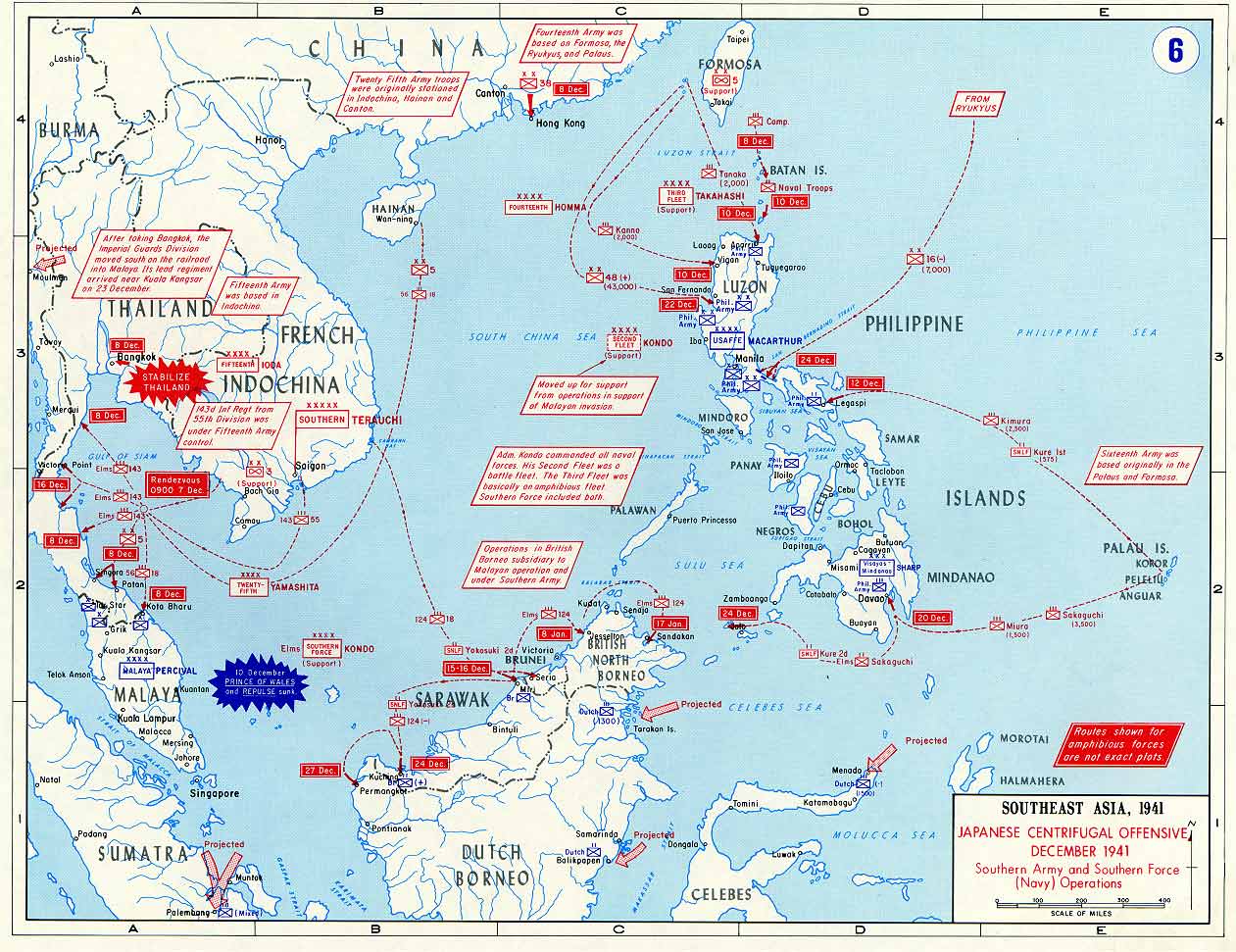
- Description: Pacific War - Southeast Asia 1941
- Source: www.westpoint.edu
- Background information:
In 1938 the predecessors of what is today The Department of History at the United States Military Academy began developing a series of campaign atlases to aid in teaching cadets a course entitled, "History of the Military Art." Since then, the Department has produced over six atlases and more than one thousand maps, encompassing not only America’s wars but global conflicts as well.
In keeping abreast with today's technology, the Department of History is providing these maps on the internet as part of the department's outreach program. The maps were created by the United States Military Academy’s Department of History and are the digital versions from the atlases printed by the United States Defense Printing Agency. We gratefully acknowledge the accomplishments of the department's former cartographer, Mr. Edward J. Krasnoborski, along with the works of our present cartographer, Mr. Frank Martini.
Please be aware that these maps are large in file size and may require substantial download times.
|
|
 |
ファイルの履歴
過去の版のファイルを表示するには、その版の日時をクリックしてください。
| 日付と時刻 | サムネイル | 寸法 | 利用者 | コメント | |
|---|---|---|---|---|---|
| 現在の版 | 2005年10月15日 (土) 10:29 | | 1,261 × 971 (178キロバイト) | W.wolny |
ファイルの使用状況
以下のページがこのファイルを使用しています:
グローバルなファイル使用状況
以下に挙げる他のウィキがこの画像を使っています:
- da.wikipedia.org での使用状況
- de.wikipedia.org での使用状況
- hr.wikipedia.org での使用状況
- lb.wikipedia.org での使用状況
- sh.wikipedia.org での使用状況
- sr.wikipedia.org での使用状況
- zh.wikipedia.org での使用状況