
ファイル:Location map Halmahera.png

このプレビューのサイズ: 569 × 599 ピクセル。 その他の解像度: 228 × 240 ピクセル | 456 × 480 ピクセル | 729 × 768 ピクセル | 973 × 1,024 ピクセル | 1,948 × 2,051 ピクセル。
元のファイル (1,948 × 2,051 ピクセル、ファイルサイズ: 326キロバイト、MIME タイプ: image/png)
ウィキメディア・コモンズのファイルページにある説明を、以下に表示します。
|
| 解説 |
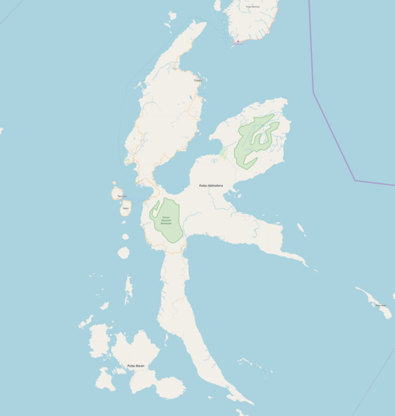
English: Map of Halmahera, Indonesia
Geographic limits of the map:
このファイルはクリエイティブ・コモンズ 表示-継承 2.0 一般ライセンスのもとに利用を許諾されています。
|
| 原典 | OpenStreetMap |
| 作者 | Dr. Blofeld |
ファイルの履歴
過去の版のファイルを表示するには、その版の日時をクリックしてください。
| 日付と時刻 | サムネイル | 寸法 | 利用者 | コメント | |
|---|---|---|---|---|---|
| 現在の版 | 2018年5月15日 (火) 20:32 | | 1,948 × 2,051 (326キロバイト) | Juxlos | Reverted to version as of 20:18, 15 May 2018 (UTC) |
| 2018年5月15日 (火) 20:21 |  | 1,948 × 2,051 (394キロバイト) | Juxlos | didn't work last time | |
| 2018年5月15日 (火) 20:18 |  | 1,948 × 2,051 (326キロバイト) | Juxlos | higher res version, with 8 years' worth of OSM data | |
| 2010年6月17日 (木) 09:40 |  | 729 × 768 (32キロバイト) | Dr. Blofeld~commonswiki | {{Information |Description={{en|1=g}} |Source=g |Author=g |Date=g |Permission= |other_versions= }} |
ファイルの使用状況
以下の 6 ページがこのファイルを使用しています:
グローバルなファイル使用状況
以下に挙げる他のウィキがこの画像を使っています:
- ar.wikipedia.org での使用状況
- ban.wikipedia.org での使用状況
- ceb.wikipedia.org での使用状況
- en.wikipedia.org での使用状況
- Patani, Indonesia
- Ternate
- Tidore
- Weda
- Sofifi
- Tobelo
- Gelora Kie Raha Stadium
- Maba, Indonesia
- Leo Wattimena Airport
- Sultan Babullah Airport
- Module:Location map/data/Indonesia Halmahera/doc
- North Halmahera Regency
- Galela (city)
- Kao, Indonesia
- Soasiu
- West Halmahera Regency
- South Halmahera Regency
- Central Halmahera Regency
- East Halmahera Regency
- Labuha
- Desa Gamtala
- Kuabang Airport
- Module:Location map/data/Indonesia Halmahera
- Pekaulang
- fa.wikipedia.org での使用状況
- fr.wikipedia.org での使用状況
- hi.wikipedia.org での使用状況
- id.wikipedia.org での使用状況
- kn.wikipedia.org での使用状況
- ml.wikipedia.org での使用状況
- simple.wikipedia.org での使用状況
- si.wikipedia.org での使用状況
- th.wikipedia.org での使用状況
このファイルのグローバル使用状況を表示する。