
ファイル:Gulf Intracoastal Waterway Galveston Bay.jpg
このプレビューのサイズ: 800 × 534 ピクセル。 その他の解像度: 320 × 214 ピクセル | 640 × 427 ピクセル | 1,024 × 683 ピクセル | 1,500 × 1,001 ピクセル。
元のファイル (1,500 × 1,001 ピクセル、ファイルサイズ: 838キロバイト、MIME タイプ: image/jpeg)
ウィキメディア・コモンズのファイルページにある説明を、以下に表示します。
|
概要
| 解説 |
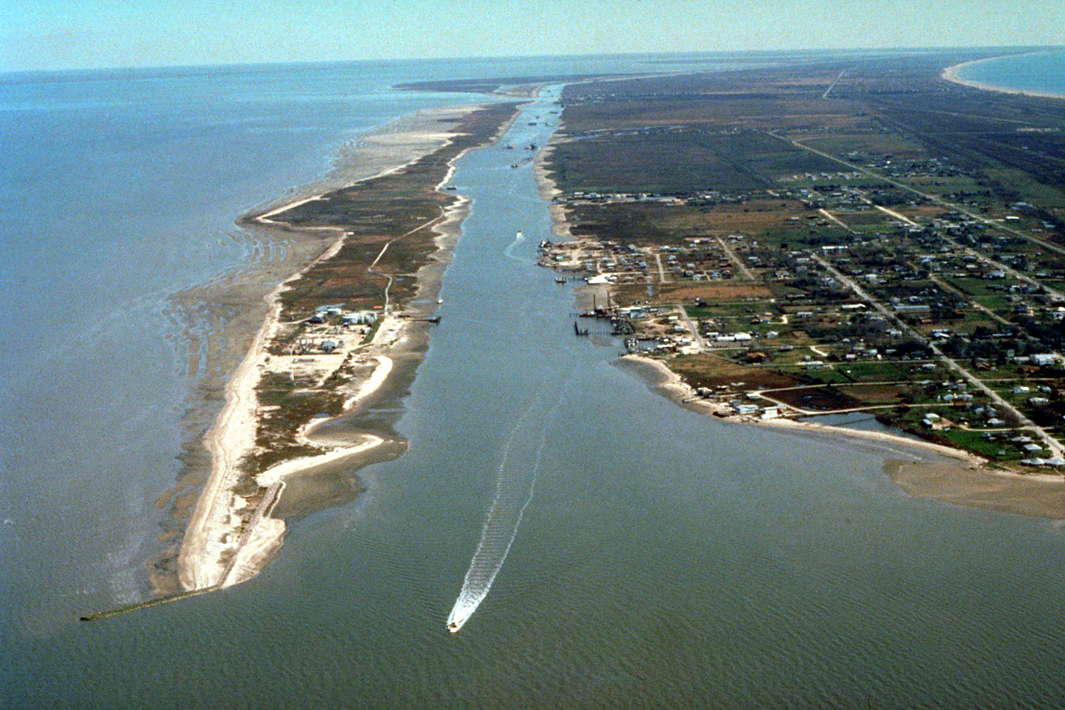
English: The Gulf Intracoastal Waterway enters Galveston Bay from the southwest end of the Bolivar Peninsula at the town of Port Bolivar, Galveston County, Texas, USA. The community of Port Bolivar lies at right at the end of the peninsula. Galveston Bay is the great body of water at left. A small piece of the Gulf of Mexico can be seen at upper right. The U.S. Army Corps of Engineers maintains and dredges the waterway for commercial barge navigation. |
| 日付 | (Caveat: Dates provided by U.S. Army Corps of Engineers Digital Visual Library are not reliable and may be wrong.) |
| 原典 |
U.S. Army Corps of Engineers Digital Visual Library Image page Image description page Digital Visual Library home page |
| 作者 | U.S. Army Corps of Engineers, photographer not specified or unknown |
| カメラの位置 | | 以下のサービスでこの位置を確認する: オープンストリートマップ |
|---|
ライセンス
This image or file is a work of a U.S. Army Corps of Engineers soldier or employee, taken or made as part of that person's official duties. As a work of the U.S. federal government, the image is in the public domain.
|
ファイルの履歴
過去の版のファイルを表示するには、その版の日時をクリックしてください。
| 日付と時刻 | サムネイル | 寸法 | 利用者 | コメント | |
|---|---|---|---|---|---|
| 現在の版 | 2007年5月10日 (木) 03:39 | | 1,500 × 1,001 (838キロバイト) | DanMS | {{Information | Description = {{en|The Gulf Intracoastal Waterway enters Galveston Bay from the southwest end of the Bolivar Peninsula at the town of Port Bolivar, Galveston County, Texas, USA. The community of Port Bolivar lies at right at the end of |
ファイルの使用状況
以下のページがこのファイルを使用しています:
グローバルなファイル使用状況
以下に挙げる他のウィキがこの画像を使っています:
- ceb.wikipedia.org での使用状況
- de.wikipedia.org での使用状況
- en.wikipedia.org での使用状況
- et.wikipedia.org での使用状況
- it.wikipedia.org での使用状況
- sl.wikipedia.org での使用状況
- www.wikidata.org での使用状況