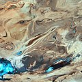
ファイル:Dasht-e Kavir.jpg

このプレビューのサイズ: 600 × 600 ピクセル。 その他の解像度: 240 × 240 ピクセル | 480 × 480 ピクセル | 768 × 768 ピクセル | 1,024 × 1,024 ピクセル | 2,049 × 2,048 ピクセル | 5,822 × 5,820 ピクセル。
元のファイル (5,822 × 5,820 ピクセル、ファイルサイズ: 3.5メガバイト、MIME タイプ: image/jpeg)
ファイルの履歴
過去の版のファイルを表示するには、その版の日時をクリックしてください。
| 日付と時刻 | サムネイル | 寸法 | 利用者 | コメント | |
|---|---|---|---|---|---|
| 現在の版 | 2006年1月18日 (水) 20:39 |  | 5,822 × 5,820 (3.5メガバイト) | David.Monniaux | ran it through jpegtran to output optimized, non-progressive jpeg |
| 2006年1月18日 (水) 20:09 |  | 5,822 × 5,820 (3.66メガバイト) | Palladinus | Dasht-e Kavir desert in Iran |
ファイルの使用状況
以下のページがこのファイルを使用しています:
グローバルなファイル使用状況
以下に挙げる他のウィキがこの画像を使っています:
- als.wikipedia.org での使用状況
- ar.wikipedia.org での使用状況
- azb.wikipedia.org での使用状況
- az.wikipedia.org での使用状況
- be.wikipedia.org での使用状況
- bg.wikipedia.org での使用状況
- bs.wikipedia.org での使用状況
- ca.wikipedia.org での使用状況
- cs.wikipedia.org での使用状況
- de.wikipedia.org での使用状況
- en.wikipedia.org での使用状況
- User:Phaedriel/Soundtrack of Wikipedians
- User:Passargea/Favourite pictures/Nature
- User:Altenmann
- Wikipedia:Featured picture candidates/February-2013
- Wikipedia:Featured picture candidates/Dasht-e Kavir
- User:Swazmo/+CarouselPics
- User:Jemspar/sandbox
- User:FormalDude/Contributions/Templates/Random Cool Picture Generator
- es.wikipedia.org での使用状況
- es.wikibooks.org での使用状況
- es.wikisource.org での使用状況
- et.wikipedia.org での使用状況
- eu.wikipedia.org での使用状況
- fa.wikipedia.org での使用状況
- دشت کویر
- ویکیپدیا:انتخاب نگاره هفته/سال ۲۰۱۱/هفته ۱
- ویکیپدیا:انتخاب نگاره هفته/سال ۲۰۱۱/هفته ۱/کویر مرکزی ایران
- ویکیپدیا:نگارههای برگزیده/پدیدههای طبیعی
- ویکیپدیا:نگارههای برگزیده/علمی/زمینشناسی
- ویکیپدیا:گزیدن نگاره برگزیده/فوریه-۲۰۱۲
- ویکیپدیا:نگاره روز/ژوئن ۲۰۱۲
- ویکیپدیا:گزیدن نگاره برگزیده/Dasht-e Kavir.jpg
- الگو:نر/2012-06-21
- الگو:نر محافظت شده/2012-06-21
- بحث کاربر:Alborzagros/بایگانی ۵
- درگاه:علوم زمین/نگاره برگزیده/۲
- درگاه:علوم زمین/نگاره برگزیده
- تصویربرداری ماهوارهای
- fr.wikipedia.org での使用状況
- gd.wikipedia.org での使用状況
- gl.wikipedia.org での使用状況
- hr.wikipedia.org での使用状況
- id.wikipedia.org での使用状況
このファイルのグローバル使用状況を表示する。


