
ファイル:County of Schwerin locator map (1250).svg

この SVG ファイルのこの PNG プレビューのサイズ: 761 × 600 ピクセル. その他の解像度: 305 × 240 ピクセル | 609 × 480 ピクセル | 975 × 768 ピクセル | 1,280 × 1,008 ピクセル | 2,560 × 2,017 ピクセル | 990 × 780 ピクセル。
元のファイル (SVG ファイル、990 × 780 ピクセル、ファイルサイズ: 3.14メガバイト)
ウィキメディア・コモンズのファイルページにある説明を、以下に表示します。
|
概要
| 解説 |
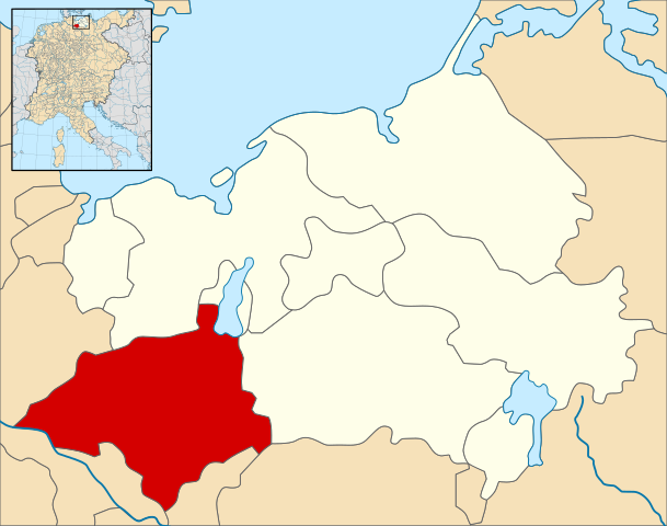
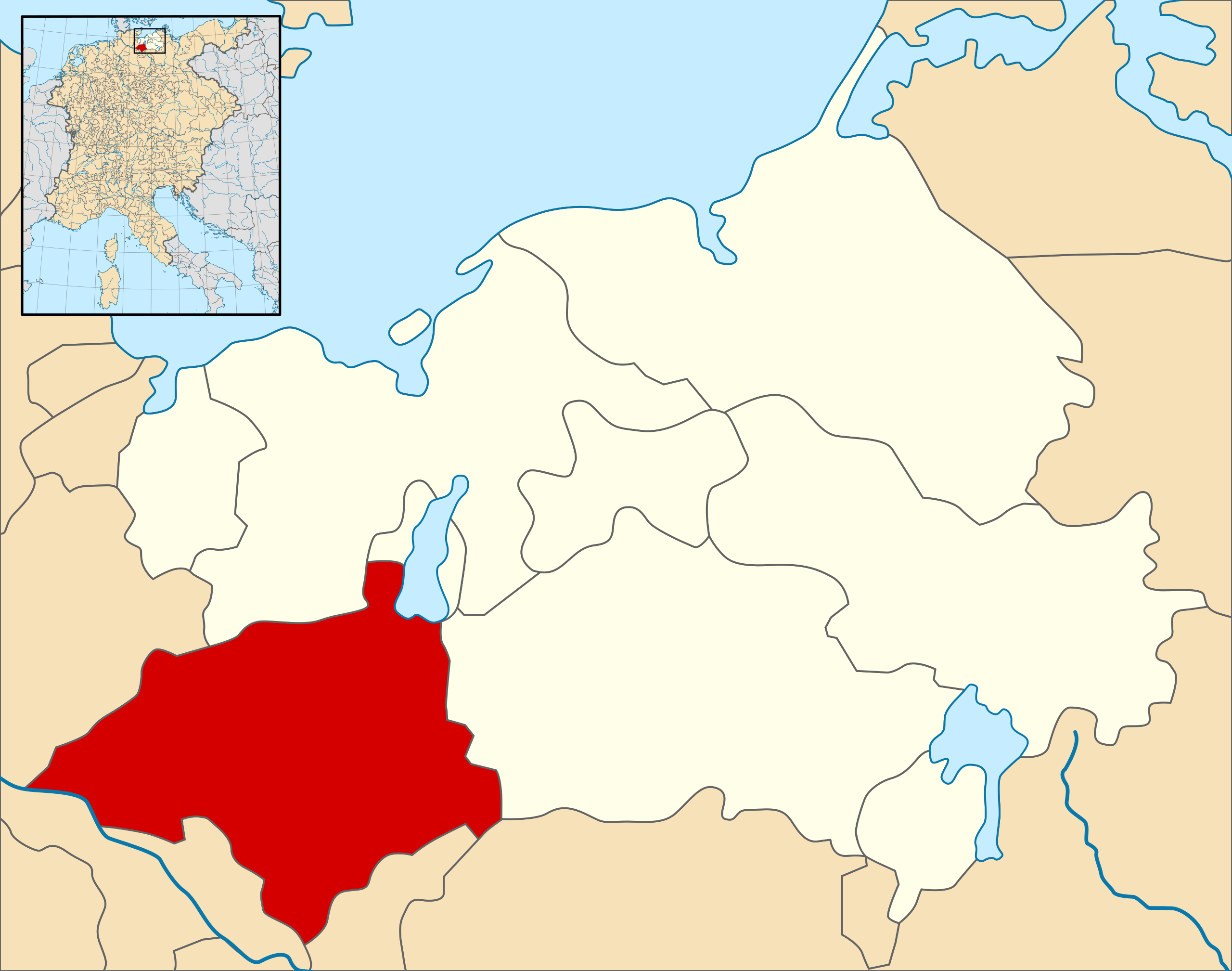
English: A map of the County of Schwerin (German: Grafschaft Schwerin) (red) at the time of the Hohenstaufen Emperors (circa 1250).
The highlighted area shows the territories that would later become the Duchy of Mecklenburg (with the exception of Strelitz/Stargard, which were still part of the Margraviate of Brandenburg at this point in history). Note that while it uses the same scheme as standard location/locator maps, this map technically does not conform to the standard, as it is not in equirectangular projection. Therefore grid lines for latitude and longitude are also included on the sub-map. |
| 日付 | |
| 原典 |
File: own work Data: Droysens-26.jpg |
| 作者 | Alphathon /ˈæɫfə.θɒn/ (talk) |
| その他のバージョン |
.svg) |
.svg)
.svg)
.svg)
.svg)
.svg)
.svg)
.svg)

.svg?uselang=ja)
.svg?uselang=ja)
.svg?uselang=ja&action=history)
.svg)
ライセンス
このファイルはクリエイティブ・コモンズ 表示-継承 4.0 国際ライセンスのもとに利用を許諾されています。
- あなたは以下の条件に従う場合に限り、自由に
- 共有 – 本作品を複製、頒布、展示、実演できます。
- 再構成 – 二次的著作物を作成できます。
- あなたの従うべき条件は以下の通りです。
- 表示 – あなたは適切なクレジットを表示し、ライセンスへのリンクを提供し、変更があったらその旨を示さなければなりません。これらは合理的であればどのような方法で行っても構いませんが、許諾者があなたやあなたの利用行為を支持していると示唆するような方法は除きます。
- 継承 – もしあなたがこの作品をリミックスしたり、改変したり、加工した場合には、あなたはあなたの貢献部分を元の作品とこれと同一または互換性があるライセンスの下に頒布しなければなりません。
ファイルの履歴
過去の版のファイルを表示するには、その版の日時をクリックしてください。
| 日付と時刻 | サムネイル | 寸法 | 利用者 | コメント | |
|---|---|---|---|---|---|
| 現在の版 | 2016年5月9日 (月) 15:21 | | 990 × 780 (3.14メガバイト) | Alphathon | == {{int:filedesc}} == {{Inkscape}} {{Information |Description={{en|A map of the County of Schwerin (German: ''Grafschaft Schwerin'') (red) at the time of the Hohenstaufen Emperors (circa 1250). The highlighted area shows the territories that would la... |
ファイルの使用状況
以下のページがこのファイルを使用しています:
グローバルなファイル使用状況
以下に挙げる他のウィキがこの画像を使っています:
- de.wikipedia.org での使用状況
- it.wikipedia.org での使用状況
- simple.wikipedia.org での使用状況
- www.wikidata.org での使用状況
.svg)