
ファイル:Former 13th Av from north jeh.jpg

このプレビューのサイズ: 800 × 302 ピクセル。 その他の解像度: 320 × 121 ピクセル | 640 × 242 ピクセル | 1,600 × 604 ピクセル。
元のファイル (1,600 × 604 ピクセル、ファイルサイズ: 83キロバイト、MIME タイプ: image/jpeg)
ウィキメディア・コモンズのファイルページにある説明を、以下に表示します。
|
概要
| 解説 |
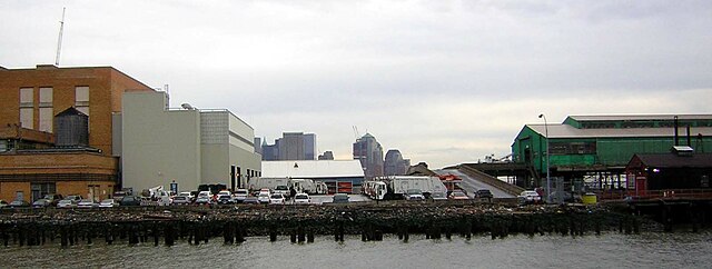
English: Gansevoort Peninsula as seen from the former Cunard Pier 54 to its north. Sanitation Department trucks line up along both sides of the former 13th Avenue on a mostly cloudy warm winter afternoon. Cars in foreground are parked on the former Bloomfield Street. |
| 日付 | 撮影日:2008年2月6日 |
| 原典 |
投稿者自身による著作物 (Original caption: " self-made ")Transferred from en.wikipedia to Commons by User:Stefan4 using CommonsHelper. |
| 作者 | Jim.henderson at en.wikipedia |
| カメラの位置 | | 以下のサービスでこの位置を確認する: オープンストリートマップ |
|---|
ライセンス
| この著作物は、著作者である英語版ウィキペディアのJim.hendersonさんによって権利が放棄され、パブリックドメインとされました。これは全世界で適用されます。 一部の国では、これが法的に可能ではない場合があります。その場合は、次のように宣言します。 Jim.hendersonは、あらゆる人に対して、法により必要とされている条件を除き、如何なる条件も課すことなく、あらゆる目的のためにこの著作物を使用する権利を与えます。 |
元のアップロードログ
元のファイルページはこちら。以下の利用者は全てen.wikipediaに属します。
- 2008-02-07 16:50 Jim.henderson 1600×604× (84949 bytes) {{Information |Description=Gansevoort Peninsula as seen from the former Cunard pier to its north. Sanitation Department trucks line up along both sides of the former [[13th Avenue (Manhattan)]] on a mostly cloudy warm winter afternoon |Source=self-made |
ファイルの履歴
過去の版のファイルを表示するには、その版の日時をクリックしてください。
| 日付と時刻 | サムネイル | 寸法 | 利用者 | コメント | |
|---|---|---|---|---|---|
| 現在の版 | 2011年11月15日 (火) 22:11 | 1,600 × 604 (83キロバイト) | File Upload Bot (Magnus Manske) | {{BotMoveToCommons|en.wikipedia|year={{subst:CURRENTYEAR}}|month={{subst:CURRENTMONTHNAME}}|day={{subst:CURRENTDAY}}}} {{Information |Description={{en|Gansevoort Peninsula as seen from the former Cunard en:Pier 54 to its north. Sanitation Departme |
ファイルの使用状況
以下のページがこのファイルを使用しています:
グローバルなファイル使用状況
以下に挙げる他のウィキがこの画像を使っています:
- en.wikipedia.org での使用状況
- es.wikipedia.org での使用状況
- fr.wikipedia.org での使用状況
- uk.wikipedia.org での使用状況