
ファイル:Youngstown Metro Counties.PNG
高解像度版はありません。
Youngstown_Metro_Counties.PNG (293 × 173 ピクセル、ファイルサイズ: 11キロバイト、MIME タイプ: image/png)
ウィキメディア・コモンズのファイルページにある説明を、以下に表示します。
|
概要
| 解説 |
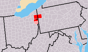
Map of Youngstown-Warren, OH-PA CSA
|
| 日付 | 7/31/2007 2:03 (UTC) |
| 原典 | Derivative work from File:Map of USA with county outlines.png, created by the author. |
| 作者 | Frank12 of English Wikipedia |
元のアップロードログ
This image is a derivative work of the following images:
- File:Map_of_USA_with_county_outlines.png licensed with Cc-by-sa-3.0-migrated, GFDL
- 2008-01-23T04:41:16Z Speight 1513x983 (100713 Bytes) Fix San Francisco Bay and Puget Sound
- 2006-11-23T22:53:51Z Ibagli 1513x983 (169345 Bytes) more fixes
- 2006-11-23T22:53:05Z Ibagli 1513x983 (169416 Bytes) Reverted to earlier revision
- 2006-11-23T22:52:41Z Ibagli 1513x983 (184378 Bytes) more fixes
- 2006-11-23T02:16:28Z Ibagli 1513x983 (169416 Bytes) fix lake St. Clair
- 2005-08-28T20:57:13Z Huhsunqu 1513x983 (169340 Bytes) *{{es}} Mapa de los [[Estados Unidos de América]] mostrando los los límites de estados miembros y sus condados. Versión a colores de la adaptación hecha por [[en:User:Wapcaplet|Wapcaplet]] del mapa de dominio público del
ライセンス
この作品の著作権者であるFrank12 at the English Wikipediaは、この作品を以下のライセンスで提供しています。

|
この文書は、フリーソフトウェア財団発行のGNUフリー文書利用許諾書 (GNU Free Documentation License) 1.2またはそれ以降のバージョンの規約に基づき、複製や再配布、改変が許可されます。不可変更部分、表紙、背表紙はありません。このライセンスの複製は、GNUフリー文書利用許諾書という章に含まれています。 |
| このファイルはクリエイティブ・コモンズ 表示-継承 3.0 非移植ライセンスのもとに利用を許諾されています。 | ||
| 帰属: Frank12 at the English Wikipedia | ||
| ||
| このライセンスのテンプレートは、GFDLのライセンス・アップデートによりこのファイルに追加されたものです。 |
ファイルの履歴
過去の版のファイルを表示するには、その版の日時をクリックしてください。
| 日付と時刻 | サムネイル | 寸法 | 利用者 | コメント | |
|---|---|---|---|---|---|
| 現在の版 | 2009年10月31日 (土) 10:44 | | 293 × 173 (11キロバイト) | Yassie | == Summary == {{Information |Description={{Information |Description= Map of Youngstown-Warren-East Liverpool, OH-PA CSA |Source= Derivative work from File:Map of USA with county outlines.png created by the author. |Date= 2007-07-31 2:03 (UTC) |Author |
ファイルの使用状況
以下のページがこのファイルを使用しています:
グローバルなファイル使用状況
以下に挙げる他のウィキがこの画像を使っています:
- en.wikipedia.org での使用状況
- tr.wikipedia.org での使用状況
- www.wikidata.org での使用状況